You are here: Home > Network List > CN - Canadian National Seismograph Network Stations List
> Station INK INUVIK, NT > Earthquake Result Viewer
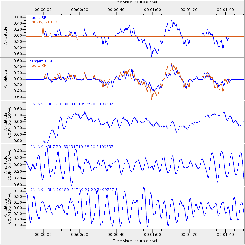
INK INUVIK, NT - Earthquake Result Viewer
*The percent match for this event was below the threshold and hence no stack was calculated.
| Earthquake location: |
Santa Cruz Islands Region |
| Earthquake latitude/longitude: |
-10.8/164.3 |
| Earthquake time(UTC): |
2018/01/31 (031) 19:15:51 GMT |
| Earthquake Depth: |
8.0 km |
| Earthquake Magnitude: |
5.5 Mww |
| Earthquake Catalog/Contributor: |
NEIC PDE/us |
|
| Network: |
CN Canadian National Seismograph Network |
| Station: |
INK INUVIK, NT |
| Lat/Lon: |
68.31 N/133.53 W |
| Elevation: |
44 m |
|
| Distance: |
90.1 deg |
| Az: |
19.193 deg |
| Baz: |
240.317 deg |
| Ray Param: |
$rayparam |
*The percent match for this event was below the threshold and hence was not used in the summary stack. |
|
| Radial Match: |
21.384007 % |
| Radial Bump: |
400 |
| Transverse Match: |
30.483433 % |
| Transverse Bump: |
400 |
| SOD ConfigId: |
13570011 |
| Insert Time: |
2019-04-29 17:07:49.178 +0000 |
| GWidth: |
2.5 |
| Max Bumps: |
400 |
| Tol: |
0.001 |
|
Signal To Noise
| Channel | StoN | STA | LTA |
| CN:INK: :BHZ:20180131T19:28:20.349973Z | 2.2367368 | 3.4349978E-7 | 1.5357183E-7 |
| CN:INK: :BHN:20180131T19:28:20.349973Z | 0.46514186 | 7.354954E-8 | 1.5812282E-7 |
| CN:INK: :BHE:20180131T19:28:20.349973Z | 0.3256382 | 1.529561E-7 | 4.697118E-7 |
| Arrivals |
| Ps | |
| PpPs | |
| PsPs/PpSs | |


