You are here: Home > Network List > TA - USArray Transportable Network (new EarthScope stations) Stations List
> Station B18K Kokolik River, AK, USA > Earthquake Result Viewer
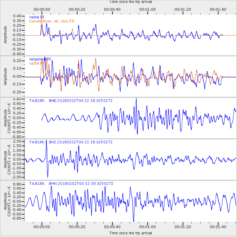
B18K Kokolik River, AK, USA - Earthquake Result Viewer
*The percent match for this event was below the threshold and hence no stack was calculated.
| Earthquake location: |
Southern Molucca Sea |
| Earthquake latitude/longitude: |
-0.2/125.2 |
| Earthquake time(UTC): |
2018/02/02 (033) 00:20:42 GMT |
| Earthquake Depth: |
38 km |
| Earthquake Magnitude: |
5.5 Mww |
| Earthquake Catalog/Contributor: |
NEIC PDE/us |
|
| Network: |
TA USArray Transportable Network (new EarthScope stations) |
| Station: |
B18K Kokolik River, AK, USA |
| Lat/Lon: |
69.36 N/161.80 W |
| Elevation: |
222 m |
|
| Distance: |
84.3 deg |
| Az: |
19.922 deg |
| Baz: |
253.977 deg |
| Ray Param: |
$rayparam |
*The percent match for this event was below the threshold and hence was not used in the summary stack. |
|
| Radial Match: |
64.9684 % |
| Radial Bump: |
400 |
| Transverse Match: |
63.26349 % |
| Transverse Bump: |
400 |
| SOD ConfigId: |
13570011 |
| Insert Time: |
2019-04-29 17:19:52.856 +0000 |
| GWidth: |
2.5 |
| Max Bumps: |
400 |
| Tol: |
0.001 |
|
Signal To Noise
| Channel | StoN | STA | LTA |
| TA:B18K: :BHZ:20180202T00:32:38.925027Z | 4.8857517 | 8.194346E-7 | 1.6771925E-7 |
| TA:B18K: :BHN:20180202T00:32:38.925027Z | 1.6405381 | 3.0595433E-7 | 1.8649634E-7 |
| TA:B18K: :BHE:20180202T00:32:38.925027Z | 2.3846533 | 2.0201313E-7 | 8.471383E-8 |
| Arrivals |
| Ps | |
| PpPs | |
| PsPs/PpSs | |


