You are here: Home > Network List > TA - USArray Transportable Network (new EarthScope stations) Stations List
> Station A21K Barrow, AK, USA > Earthquake Result Viewer
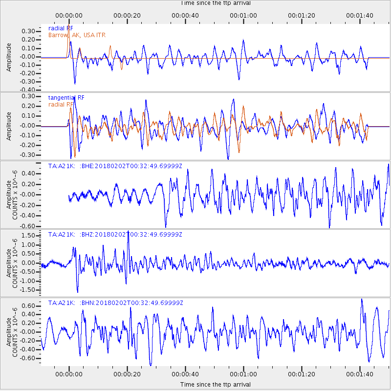
A21K Barrow, AK, USA - Earthquake Result Viewer
*The percent match for this event was below the threshold and hence no stack was calculated.
| Earthquake location: |
Southern Molucca Sea |
| Earthquake latitude/longitude: |
-0.2/125.2 |
| Earthquake time(UTC): |
2018/02/02 (033) 00:20:42 GMT |
| Earthquake Depth: |
38 km |
| Earthquake Magnitude: |
5.5 Mww |
| Earthquake Catalog/Contributor: |
NEIC PDE/us |
|
| Network: |
TA USArray Transportable Network (new EarthScope stations) |
| Station: |
A21K Barrow, AK, USA |
| Lat/Lon: |
71.32 N/156.62 W |
| Elevation: |
577 m |
|
| Distance: |
86.5 deg |
| Az: |
18.42 deg |
| Baz: |
258.735 deg |
| Ray Param: |
$rayparam |
*The percent match for this event was below the threshold and hence was not used in the summary stack. |
|
| Radial Match: |
54.789402 % |
| Radial Bump: |
400 |
| Transverse Match: |
71.67914 % |
| Transverse Bump: |
400 |
| SOD ConfigId: |
13570011 |
| Insert Time: |
2019-04-29 17:19:53.629 +0000 |
| GWidth: |
2.5 |
| Max Bumps: |
400 |
| Tol: |
0.001 |
|
Signal To Noise
| Channel | StoN | STA | LTA |
| TA:A21K: :BHZ:20180202T00:32:49.69999Z | 5.9402328 | 6.0021944E-7 | 1.01043085E-7 |
| TA:A21K: :BHN:20180202T00:32:49.69999Z | 1.1820977 | 2.3123584E-7 | 1.9561485E-7 |
| TA:A21K: :BHE:20180202T00:32:49.69999Z | 2.9212134 | 2.4565702E-7 | 8.409417E-8 |
| Arrivals |
| Ps | |
| PpPs | |
| PsPs/PpSs | |


