You are here: Home > Network List > TA - USArray Transportable Network (new EarthScope stations) Stations List
> Station C16K Lisburne Hills, AK, USA > Earthquake Result Viewer
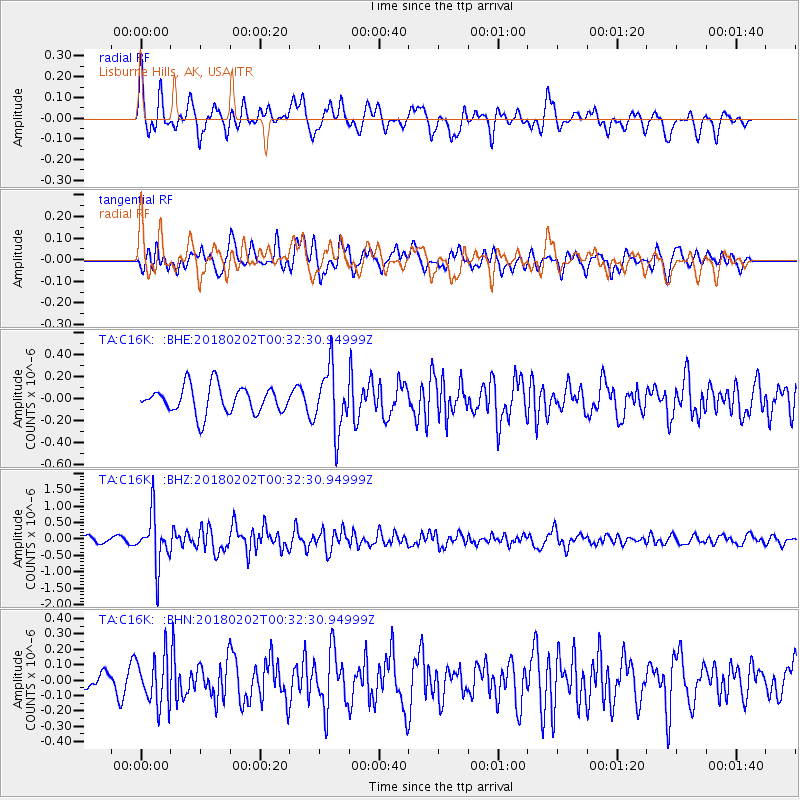
C16K Lisburne Hills, AK, USA - Earthquake Result Viewer
*The percent match for this event was below the threshold and hence no stack was calculated.
| Earthquake location: |
Southern Molucca Sea |
| Earthquake latitude/longitude: |
-0.2/125.2 |
| Earthquake time(UTC): |
2018/02/02 (033) 00:20:42 GMT |
| Earthquake Depth: |
38 km |
| Earthquake Magnitude: |
5.5 Mww |
| Earthquake Catalog/Contributor: |
NEIC PDE/us |
|
| Network: |
TA USArray Transportable Network (new EarthScope stations) |
| Station: |
C16K Lisburne Hills, AK, USA |
| Lat/Lon: |
68.27 N/165.34 W |
| Elevation: |
102 m |
|
| Distance: |
82.7 deg |
| Az: |
20.579 deg |
| Baz: |
250.751 deg |
| Ray Param: |
$rayparam |
*The percent match for this event was below the threshold and hence was not used in the summary stack. |
|
| Radial Match: |
67.38287 % |
| Radial Bump: |
388 |
| Transverse Match: |
68.26415 % |
| Transverse Bump: |
400 |
| SOD ConfigId: |
13570011 |
| Insert Time: |
2019-04-29 17:19:54.189 +0000 |
| GWidth: |
2.5 |
| Max Bumps: |
400 |
| Tol: |
0.001 |
|
Signal To Noise
| Channel | StoN | STA | LTA |
| TA:C16K: :BHZ:20180202T00:32:30.94999Z | 7.2363133 | 7.769668E-7 | 1.0737053E-7 |
| TA:C16K: :BHN:20180202T00:32:30.94999Z | 2.1802473 | 1.5736362E-7 | 7.217695E-8 |
| TA:C16K: :BHE:20180202T00:32:30.94999Z | 2.298862 | 2.806267E-7 | 1.22072E-7 |
| Arrivals |
| Ps | |
| PpPs | |
| PsPs/PpSs | |


