You are here: Home > Network List > TA - USArray Transportable Network (new EarthScope stations) Stations List
> Station K15K Wolf Creek Mountain, AK, USA > Earthquake Result Viewer
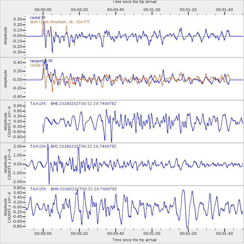
K15K Wolf Creek Mountain, AK, USA - Earthquake Result Viewer
*The percent match for this event was below the threshold and hence no stack was calculated.
| Earthquake location: |
Southern Molucca Sea |
| Earthquake latitude/longitude: |
-0.2/125.2 |
| Earthquake time(UTC): |
2018/02/02 (033) 00:20:42 GMT |
| Earthquake Depth: |
38 km |
| Earthquake Magnitude: |
5.5 Mww |
| Earthquake Catalog/Contributor: |
NEIC PDE/us |
|
| Network: |
TA USArray Transportable Network (new EarthScope stations) |
| Station: |
K15K Wolf Creek Mountain, AK, USA |
| Lat/Lon: |
62.29 N/161.53 W |
| Elevation: |
346 m |
|
| Distance: |
82.5 deg |
| Az: |
26.841 deg |
| Baz: |
255.022 deg |
| Ray Param: |
$rayparam |
*The percent match for this event was below the threshold and hence was not used in the summary stack. |
|
| Radial Match: |
64.83871 % |
| Radial Bump: |
400 |
| Transverse Match: |
68.82678 % |
| Transverse Bump: |
400 |
| SOD ConfigId: |
13570011 |
| Insert Time: |
2019-04-29 17:20:27.140 +0000 |
| GWidth: |
2.5 |
| Max Bumps: |
400 |
| Tol: |
0.001 |
|
Signal To Noise
| Channel | StoN | STA | LTA |
| TA:K15K: :BHZ:20180202T00:32:29.749978Z | 5.160361 | 8.3502835E-7 | 1.6181588E-7 |
| TA:K15K: :BHN:20180202T00:32:29.749978Z | 0.5733005 | 1.5276571E-7 | 2.6646708E-7 |
| TA:K15K: :BHE:20180202T00:32:29.749978Z | 1.8172584 | 4.3121432E-7 | 2.3728839E-7 |
| Arrivals |
| Ps | |
| PpPs | |
| PsPs/PpSs | |


