You are here: Home > Network List > UU - University of Utah Regional Network Stations List
> Station FORU South Mineral Mountains, UT, USA > Earthquake Result Viewer
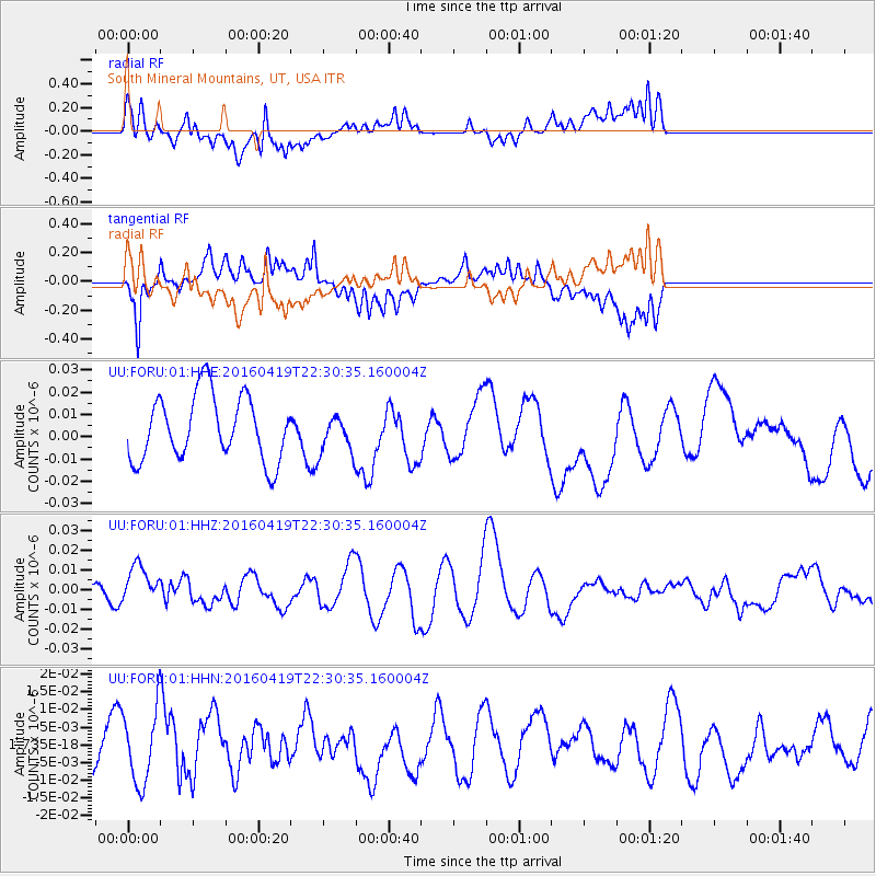
FORU South Mineral Mountains, UT, USA - Earthquake Result Viewer
*The percent match for this event was below the threshold and hence no stack was calculated.
| Earthquake location: |
Near Coast Of Ecuador |
| Earthquake latitude/longitude: |
0.6/-80.1 |
| Earthquake time(UTC): |
2016/04/19 (110) 22:22:26 GMT |
| Earthquake Depth: |
15 km |
| Earthquake Magnitude: |
5.5 MB |
| Earthquake Catalog/Contributor: |
NEIC PDE/NEIC ALERT |
|
| Network: |
UU University of Utah Regional Network |
| Station: |
FORU South Mineral Mountains, UT, USA |
| Lat/Lon: |
38.46 N/112.86 W |
| Elevation: |
1840 m |
|
| Distance: |
48.3 deg |
| Az: |
325.241 deg |
| Baz: |
133.434 deg |
| Ray Param: |
$rayparam |
*The percent match for this event was below the threshold and hence was not used in the summary stack. |
|
| Radial Match: |
37.404358 % |
| Radial Bump: |
400 |
| Transverse Match: |
63.715145 % |
| Transverse Bump: |
400 |
| SOD ConfigId: |
1475611 |
| Insert Time: |
2016-05-03 22:42:18.831 +0000 |
| GWidth: |
2.5 |
| Max Bumps: |
400 |
| Tol: |
0.001 |
|
Signal To Noise
| Channel | StoN | STA | LTA |
| UU:FORU:01:HHZ:20160419T22:30:35.160004Z | 1.305213 | 9.831469E-9 | 7.5324635E-9 |
| UU:FORU:01:HHN:20160419T22:30:35.160004Z | 2.2911794 | 1.0017736E-8 | 4.372305E-9 |
| UU:FORU:01:HHE:20160419T22:30:35.160004Z | 0.5791575 | 8.4160225E-9 | 1.4531493E-8 |
| Arrivals |
| Ps | |
| PpPs | |
| PsPs/PpSs | |


