You are here: Home > Network List > WY - Yellowstone Wyoming Seismic Network Stations List
> Station YHH Holmes Hill, YNP, WY, USA > Earthquake Result Viewer
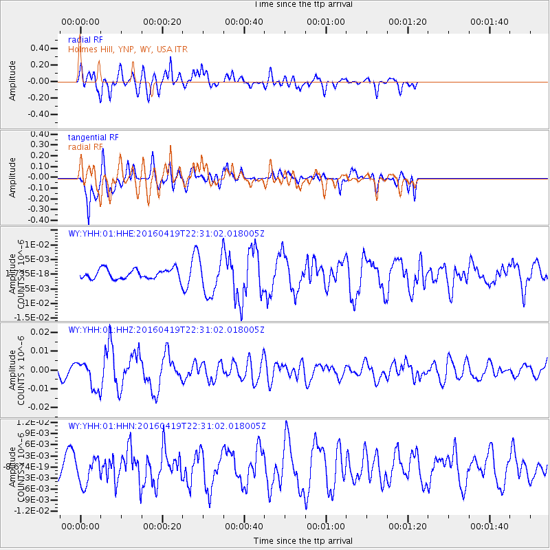
YHH Holmes Hill, YNP, WY, USA - Earthquake Result Viewer
*The percent match for this event was below the threshold and hence no stack was calculated.
| Earthquake location: |
Near Coast Of Ecuador |
| Earthquake latitude/longitude: |
0.6/-80.1 |
| Earthquake time(UTC): |
2016/04/19 (110) 22:22:26 GMT |
| Earthquake Depth: |
15 km |
| Earthquake Magnitude: |
5.5 MB |
| Earthquake Catalog/Contributor: |
NEIC PDE/NEIC ALERT |
|
| Network: |
WY Yellowstone Wyoming Seismic Network |
| Station: |
YHH Holmes Hill, YNP, WY, USA |
| Lat/Lon: |
44.79 N/110.85 W |
| Elevation: |
2717 m |
|
| Distance: |
51.8 deg |
| Az: |
332.359 deg |
| Baz: |
139.346 deg |
| Ray Param: |
$rayparam |
*The percent match for this event was below the threshold and hence was not used in the summary stack. |
|
| Radial Match: |
77.27412 % |
| Radial Bump: |
400 |
| Transverse Match: |
59.6331 % |
| Transverse Bump: |
389 |
| SOD ConfigId: |
1475611 |
| Insert Time: |
2016-05-03 22:43:17.216 +0000 |
| GWidth: |
2.5 |
| Max Bumps: |
400 |
| Tol: |
0.001 |
|
Signal To Noise
| Channel | StoN | STA | LTA |
| WY:YHH:01:HHZ:20160419T22:31:02.018005Z | 3.9424605 | 7.472438E-9 | 1.895374E-9 |
| WY:YHH:01:HHN:20160419T22:31:02.018005Z | 1.1295294 | 3.5211363E-9 | 3.1173482E-9 |
| WY:YHH:01:HHE:20160419T22:31:02.018005Z | 3.7703936 | 6.30357E-9 | 1.67186E-9 |
| Arrivals |
| Ps | |
| PpPs | |
| PsPs/PpSs | |


