You are here: Home > Network List > TA - USArray Transportable Network (new EarthScope stations) Stations List
> Station C16K Lisburne Hills, AK, USA > Earthquake Result Viewer
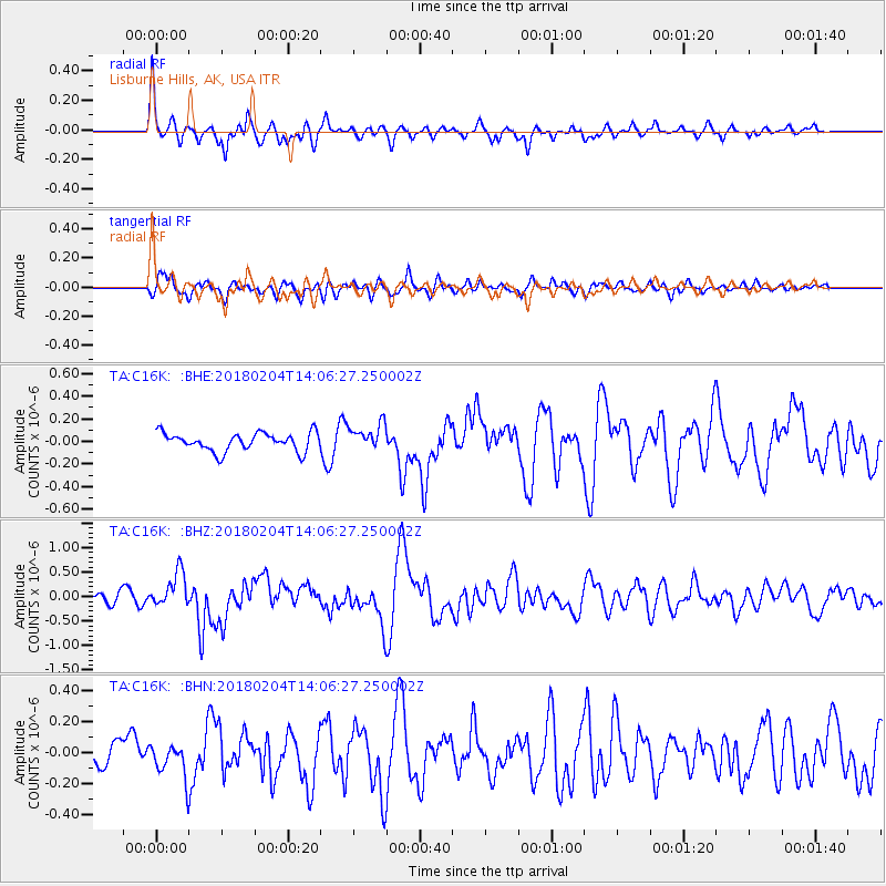
C16K Lisburne Hills, AK, USA - Earthquake Result Viewer
*The percent match for this event was below the threshold and hence no stack was calculated.
| Earthquake location: |
Taiwan |
| Earthquake latitude/longitude: |
24.1/121.7 |
| Earthquake time(UTC): |
2018/02/04 (035) 13:56:41 GMT |
| Earthquake Depth: |
7.8 km |
| Earthquake Magnitude: |
6.1 Mww |
| Earthquake Catalog/Contributor: |
NEIC PDE/us |
|
| Network: |
TA USArray Transportable Network (new EarthScope stations) |
| Station: |
C16K Lisburne Hills, AK, USA |
| Lat/Lon: |
68.27 N/165.34 W |
| Elevation: |
102 m |
|
| Distance: |
61.6 deg |
| Az: |
23.887 deg |
| Baz: |
263.679 deg |
| Ray Param: |
$rayparam |
*The percent match for this event was below the threshold and hence was not used in the summary stack. |
|
| Radial Match: |
68.02527 % |
| Radial Bump: |
377 |
| Transverse Match: |
44.93476 % |
| Transverse Bump: |
400 |
| SOD ConfigId: |
13570011 |
| Insert Time: |
2019-04-29 17:26:19.476 +0000 |
| GWidth: |
2.5 |
| Max Bumps: |
400 |
| Tol: |
0.001 |
|
Signal To Noise
| Channel | StoN | STA | LTA |
| TA:C16K: :BHZ:20180204T14:06:27.250002Z | 3.5215948 | 3.559234E-7 | 1.01068814E-7 |
| TA:C16K: :BHN:20180204T14:06:27.250002Z | 1.2027737 | 1.0635829E-7 | 8.842752E-8 |
| TA:C16K: :BHE:20180204T14:06:27.250002Z | 1.411426 | 1.1278776E-7 | 7.99105E-8 |
| Arrivals |
| Ps | |
| PpPs | |
| PsPs/PpSs | |


