You are here: Home > Network List > TA - USArray Transportable Network (new EarthScope stations) Stations List
> Station E20K Nigu River, AK, USA > Earthquake Result Viewer
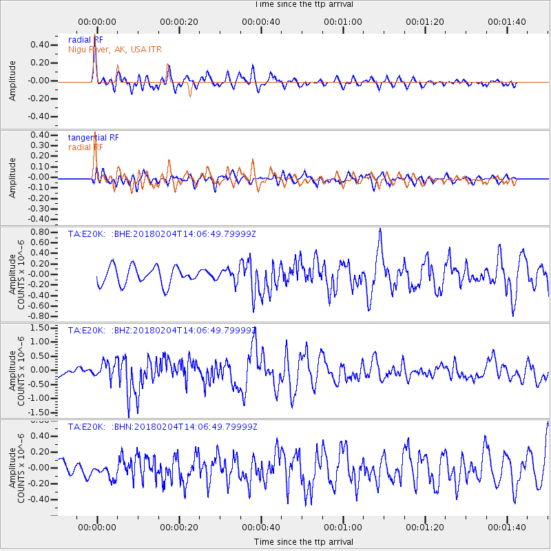
E20K Nigu River, AK, USA - Earthquake Result Viewer
*The percent match for this event was below the threshold and hence no stack was calculated.
| Earthquake location: |
Taiwan |
| Earthquake latitude/longitude: |
24.1/121.7 |
| Earthquake time(UTC): |
2018/02/04 (035) 13:56:41 GMT |
| Earthquake Depth: |
7.8 km |
| Earthquake Magnitude: |
6.1 Mww |
| Earthquake Catalog/Contributor: |
NEIC PDE/us |
|
| Network: |
TA USArray Transportable Network (new EarthScope stations) |
| Station: |
E20K Nigu River, AK, USA |
| Lat/Lon: |
68.26 N/156.19 W |
| Elevation: |
866 m |
|
| Distance: |
65.0 deg |
| Az: |
24.042 deg |
| Baz: |
272.247 deg |
| Ray Param: |
$rayparam |
*The percent match for this event was below the threshold and hence was not used in the summary stack. |
|
| Radial Match: |
67.791336 % |
| Radial Bump: |
400 |
| Transverse Match: |
45.798016 % |
| Transverse Bump: |
400 |
| SOD ConfigId: |
13570011 |
| Insert Time: |
2019-04-29 17:26:29.689 +0000 |
| GWidth: |
2.5 |
| Max Bumps: |
400 |
| Tol: |
0.001 |
|
Signal To Noise
| Channel | StoN | STA | LTA |
| TA:E20K: :BHZ:20180204T14:06:49.79999Z | 3.624083 | 2.8851832E-7 | 7.9611404E-8 |
| TA:E20K: :BHN:20180204T14:06:49.79999Z | 1.0653162 | 8.9882015E-8 | 8.437121E-8 |
| TA:E20K: :BHE:20180204T14:06:49.79999Z | 0.8502322 | 1.4009676E-7 | 1.647747E-7 |
| Arrivals |
| Ps | |
| PpPs | |
| PsPs/PpSs | |


