You are here: Home > Network List > TA - USArray Transportable Network (new EarthScope stations) Stations List
> Station G21K Allakaket, AK, USA > Earthquake Result Viewer
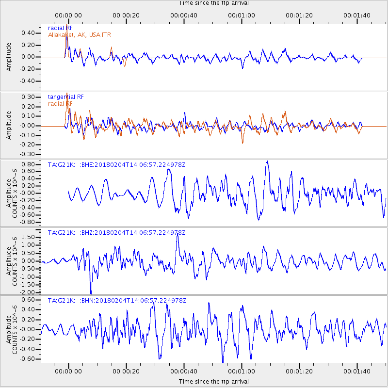
G21K Allakaket, AK, USA - Earthquake Result Viewer
*The percent match for this event was below the threshold and hence no stack was calculated.
| Earthquake location: |
Taiwan |
| Earthquake latitude/longitude: |
24.1/121.7 |
| Earthquake time(UTC): |
2018/02/04 (035) 13:56:41 GMT |
| Earthquake Depth: |
7.8 km |
| Earthquake Magnitude: |
6.1 Mww |
| Earthquake Catalog/Contributor: |
NEIC PDE/us |
|
| Network: |
TA USArray Transportable Network (new EarthScope stations) |
| Station: |
G21K Allakaket, AK, USA |
| Lat/Lon: |
66.52 N/153.51 W |
| Elevation: |
446 m |
|
| Distance: |
66.1 deg |
| Az: |
25.883 deg |
| Baz: |
275.484 deg |
| Ray Param: |
$rayparam |
*The percent match for this event was below the threshold and hence was not used in the summary stack. |
|
| Radial Match: |
56.535583 % |
| Radial Bump: |
358 |
| Transverse Match: |
41.762386 % |
| Transverse Bump: |
342 |
| SOD ConfigId: |
13570011 |
| Insert Time: |
2019-04-29 17:26:36.561 +0000 |
| GWidth: |
2.5 |
| Max Bumps: |
400 |
| Tol: |
0.001 |
|
Signal To Noise
| Channel | StoN | STA | LTA |
| TA:G21K: :BHZ:20180204T14:06:57.224978Z | 1.8876582 | 2.4592845E-7 | 1.302823E-7 |
| TA:G21K: :BHN:20180204T14:06:57.224978Z | 0.6944534 | 9.2961365E-8 | 1.3386263E-7 |
| TA:G21K: :BHE:20180204T14:06:57.224978Z | 2.515351 | 3.7970887E-7 | 1.5095661E-7 |
| Arrivals |
| Ps | |
| PpPs | |
| PsPs/PpSs | |


