C13A Hot Springs, MT, USA - Earthquake Result Viewer
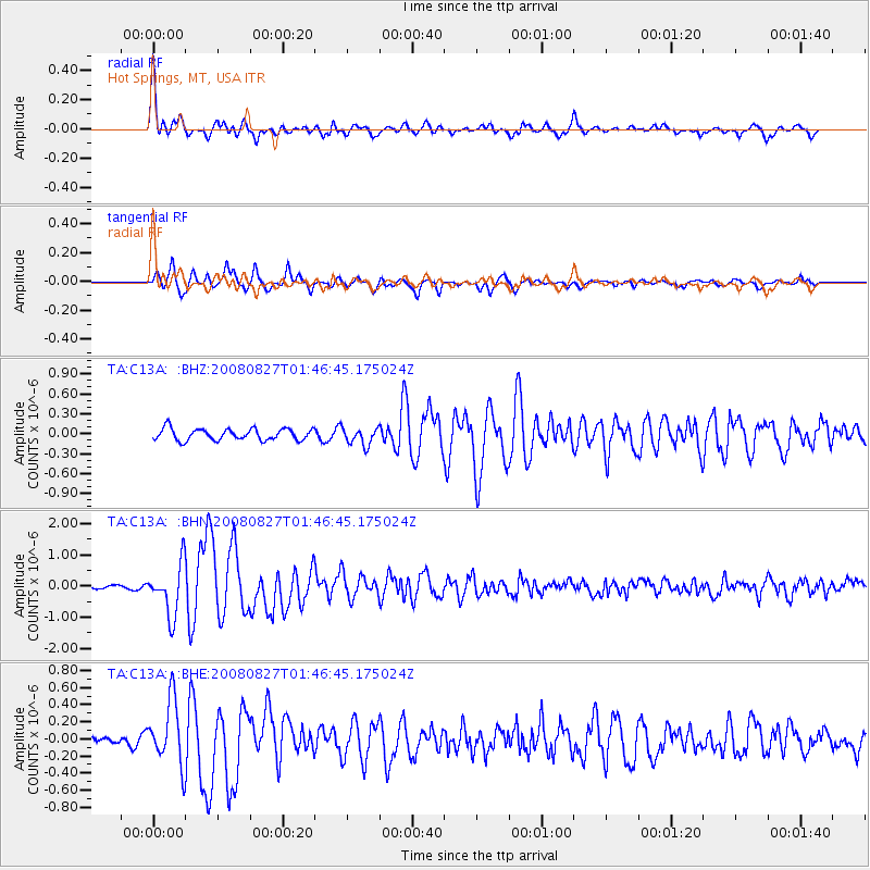
Earthquake location: Lake Baykal Region, Russia
Earthquake latitude/longitude: 51.6/104.2
Earthquake time(UTC): 2008/08/27 (240) 01:35:32 GMT
Earthquake Depth: 16 km
Earthquake Magnitude: 5.8 MB, 6.2 MS, 6.2 MW, 6.2 MW
Earthquake Catalog/Contributor: WHDF/NEIC
Network: TA USArray Transportable Network (new EarthScope stations)
Station: C13A Hot Springs, MT, USA
Lat/Lon: 47.68 N/114.57 W
Elevation: 976 m
Distance: 75.7 deg
Az: 25.873 deg
Baz: 336.252 deg
Ray Param: 0.051501032
Estimated Moho Depth: 23.5 km
Estimated Crust Vp/Vs: 1.87
Assumed Crust Vp: 6.622 km/s
Estimated Crust Vs: 3.551 km/s
Estimated Crust Poisson's Ratio: 0.30
Radial Match: 91.48729 %
Radial Bump: 400
Transverse Match: 86.5331 %
Transverse Bump: 400
SOD ConfigId: 2504
Insert Time: 2010-03-06 08:37:50.425 +0000
GWidth: 2.5
Max Bumps: 400
Tol: 0.001

Signal To Noise

ChannelStoNSTALTA
TA:C13A: :BHN:20080827T01:46:45.175024Z8.8068088.123443E-79.2240484E-8
TA:C13A: :BHE:20080827T01:46:45.175024Z5.72403143.70238E-76.468134E-8
TA:C13A: :BHZ:20080827T01:46:45.175024Z1.44917051.26618E-78.737275E-8
Arrivals
Ps3.2 SECOND
PpPs9.8 SECOND
PsPs/PpSs13 SECOND