You are here: Home > Network List > UW - Pacific Northwest Regional Seismic Network Stations List
> Station HOOD Mt Hood Meadows, OR CREST BB SMO > Earthquake Result Viewer
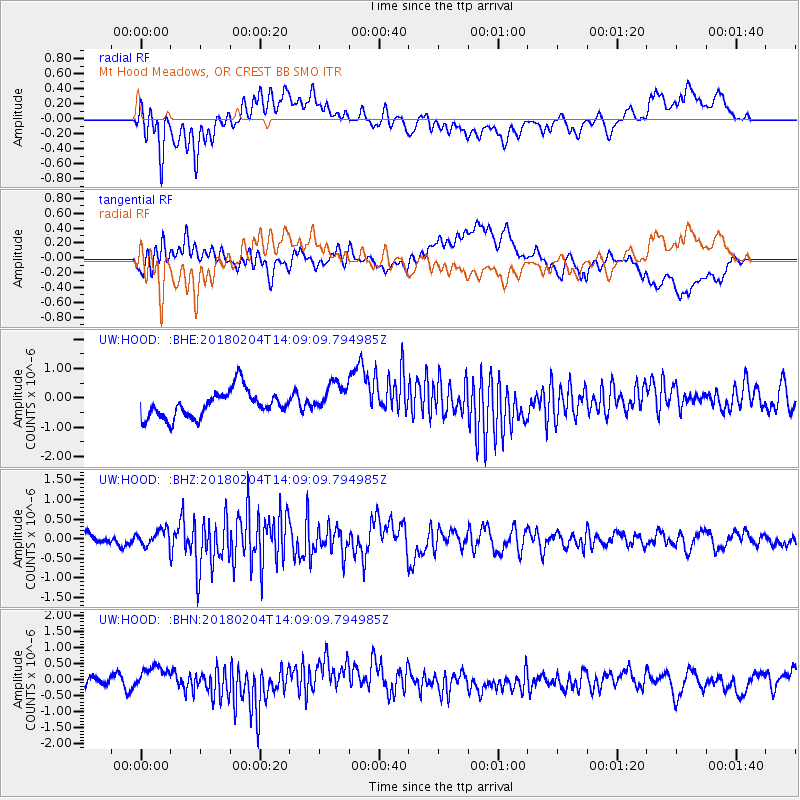
HOOD Mt Hood Meadows, OR CREST BB SMO - Earthquake Result Viewer
*The percent match for this event was below the threshold and hence no stack was calculated.
| Earthquake location: |
Taiwan |
| Earthquake latitude/longitude: |
24.1/121.7 |
| Earthquake time(UTC): |
2018/02/04 (035) 13:56:41 GMT |
| Earthquake Depth: |
7.8 km |
| Earthquake Magnitude: |
6.1 Mww |
| Earthquake Catalog/Contributor: |
NEIC PDE/us |
|
| Network: |
UW Pacific Northwest Regional Seismic Network |
| Station: |
HOOD Mt Hood Meadows, OR CREST BB SMO |
| Lat/Lon: |
45.32 N/121.65 W |
| Elevation: |
1520 m |
|
| Distance: |
90.1 deg |
| Az: |
39.076 deg |
| Baz: |
305.266 deg |
| Ray Param: |
$rayparam |
*The percent match for this event was below the threshold and hence was not used in the summary stack. |
|
| Radial Match: |
65.49662 % |
| Radial Bump: |
400 |
| Transverse Match: |
52.70586 % |
| Transverse Bump: |
400 |
| SOD ConfigId: |
13570011 |
| Insert Time: |
2019-04-29 17:27:13.274 +0000 |
| GWidth: |
2.5 |
| Max Bumps: |
400 |
| Tol: |
0.001 |
|
Signal To Noise
| Channel | StoN | STA | LTA |
| UW:HOOD: :BHZ:20180204T14:09:09.794985Z | 1.4087063 | 2.0105763E-7 | 1.4272503E-7 |
| UW:HOOD: :BHN:20180204T14:09:09.794985Z | 1.1487654 | 4.061636E-7 | 3.535653E-7 |
| UW:HOOD: :BHE:20180204T14:09:09.794985Z | 1.31777 | 5.910139E-7 | 4.4849546E-7 |
| Arrivals |
| Ps | |
| PpPs | |
| PsPs/PpSs | |


