C13A Hot Springs, MT, USA - Earthquake Result Viewer
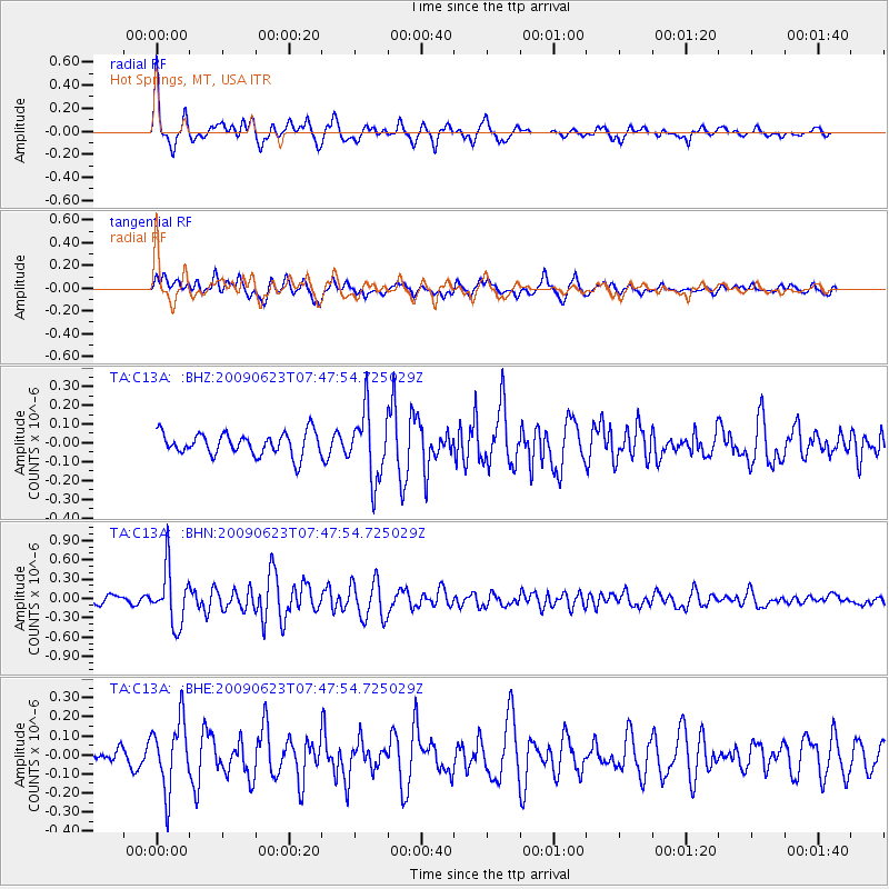
Earthquake location: Near East Coast Of Honshu, Japan
Earthquake latitude/longitude: 38.8/142.4
Earthquake time(UTC): 2009/06/23 (174) 07:37:17 GMT
Earthquake Depth: 37 km
Earthquake Magnitude: 5.7 MB, 5.0 MS, 5.6 MW, 5.6 MW
Earthquake Catalog/Contributor: WHDF/NEIC
Network: TA USArray Transportable Network (new EarthScope stations)
Station: C13A Hot Springs, MT, USA
Lat/Lon: 47.68 N/114.57 W
Elevation: 976 m
Distance: 70.0 deg
Az: 44.461 deg
Baz: 305.966 deg
Ray Param: 0.05519047
Estimated Moho Depth: 25.5 km
Estimated Crust Vp/Vs: 2.09
Assumed Crust Vp: 6.622 km/s
Estimated Crust Vs: 3.169 km/s
Estimated Crust Poisson's Ratio: 0.35
Radial Match: 82.09196 %
Radial Bump: 391
Transverse Match: 68.81057 %
Transverse Bump: 400
SOD ConfigId: 2648
Insert Time: 2010-03-06 08:38:45.248 +0000
GWidth: 2.5
Max Bumps: 400
Tol: 0.001

Signal To Noise

ChannelStoNSTALTA
TA:C13A: :BHN:20090623T07:47:54.725029Z6.7142544.3169595E-76.429545E-8
TA:C13A: :BHE:20090623T07:47:54.725029Z3.9278871.8101271E-74.608399E-8
TA:C13A: :BHZ:20090623T07:47:54.725029Z3.03266331.8026637E-75.94416E-8
Arrivals
Ps4.3 SECOND
PpPs12 SECOND
PsPs/PpSs16 SECOND