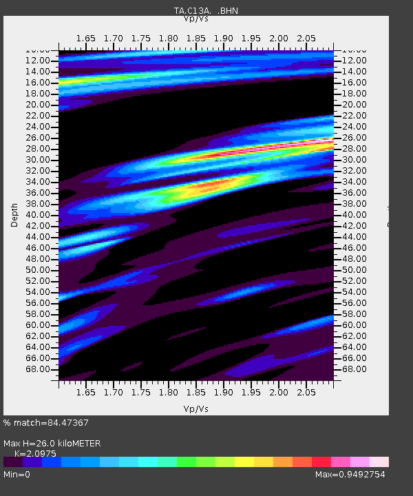
C13A Hot Springs, MT, USA - Earthquake Result Viewer
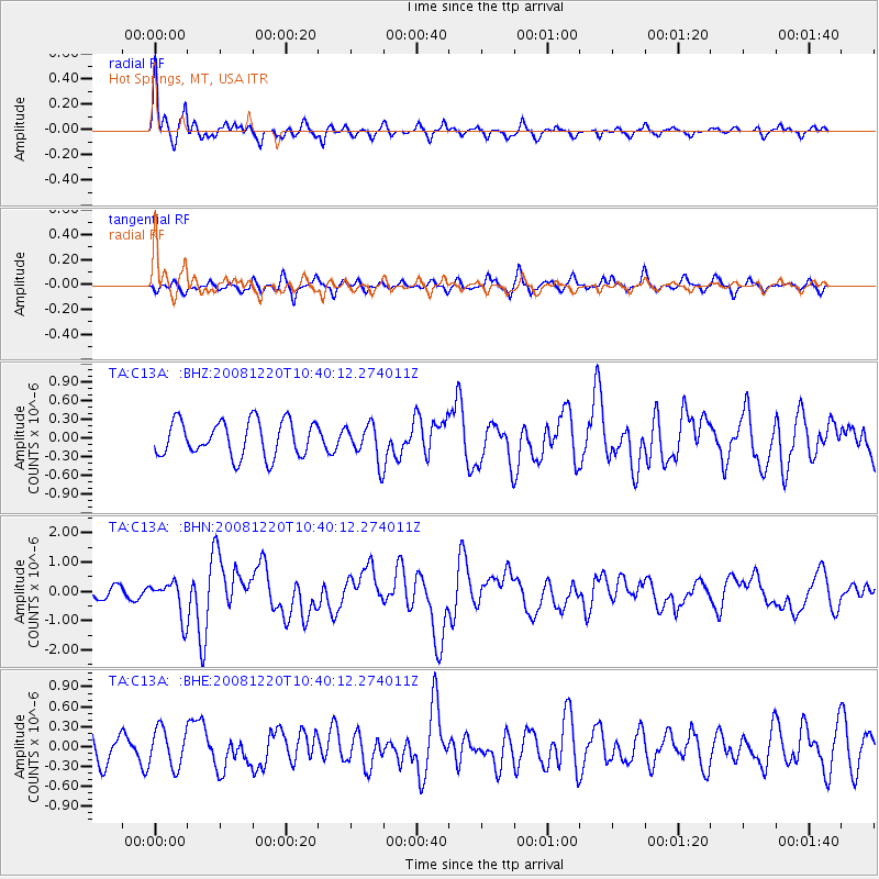
Earthquake location: Off East Coast Of Honshu, Japan
Earthquake latitude/longitude: 36.5/142.4
Earthquake time(UTC): 2008/12/20 (355) 10:29:23 GMT
Earthquake Depth: 19 km
Earthquake Magnitude: 6.0 MB, 6.3 MS, 6.3 MW, 6.3 MW
Earthquake Catalog/Contributor: WHDF/NEIC
Network: TA USArray Transportable Network (new EarthScope stations)
Station: C13A Hot Springs, MT, USA
Lat/Lon: 47.68 N/114.57 W
Elevation: 976 m
Distance: 71.7 deg
Az: 43.918 deg
Baz: 304.244 deg
Ray Param: 0.054157745
Estimated Moho Depth: 26.0 km
Estimated Crust Vp/Vs: 2.10
Assumed Crust Vp: 6.622 km/s
Estimated Crust Vs: 3.157 km/s
Estimated Crust Poisson's Ratio: 0.35
Radial Match: 84.47367 %
Radial Bump: 397
Transverse Match: 67.71183 %
Transverse Bump: 400
SOD ConfigId: 2658
Insert Time: 2010-03-06 08:38:46.679 +0000
GWidth: 2.5
Max Bumps: 400
Tol: 0.001

Signal To Noise

ChannelStoNSTALTA
TA:C13A: :BHN:20081220T10:40:12.274011Z3.41507056.11453E-71.790455E-7
TA:C13A: :BHE:20081220T10:40:12.274011Z1.19507052.8488722E-72.3838528E-7
TA:C13A: :BHZ:20081220T10:40:12.274011Z1.0327412.9192077E-72.82666E-7
Arrivals
Ps4.4 SECOND
PpPs12 SECOND
PsPs/PpSs16 SECOND