
C13A Hot Springs, MT, USA - Earthquake Result Viewer
| ||||||||||||||||||
| ||||||||||||||||||
| ||||||||||||||||||
|
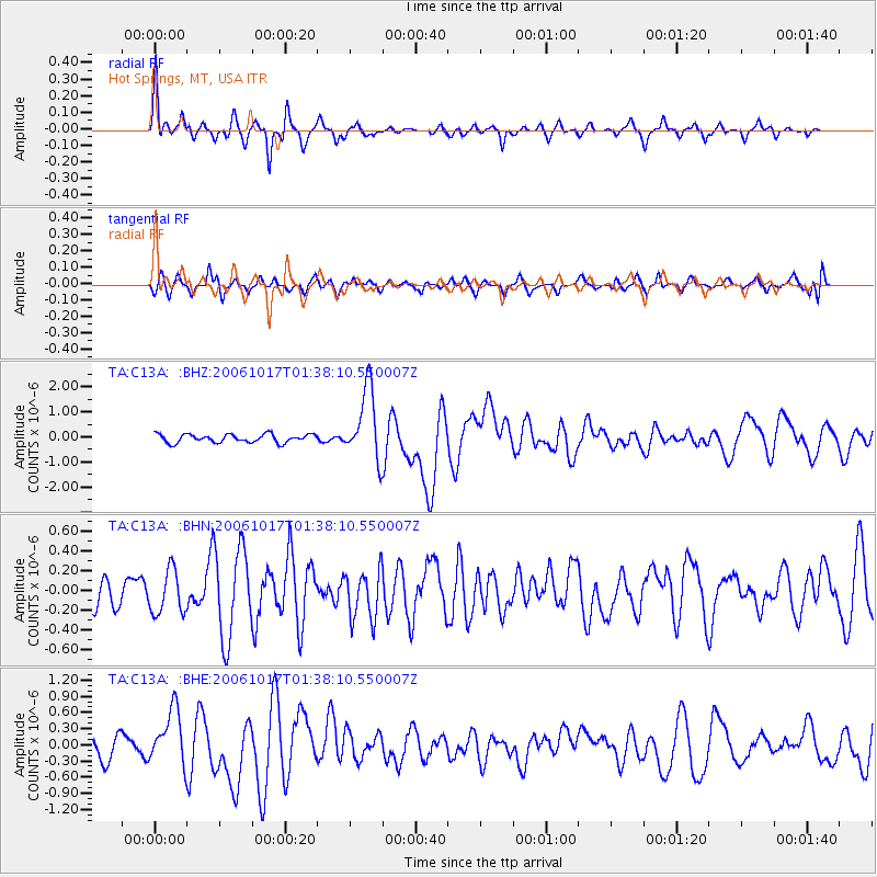
Signal To Noise
| Channel | StoN | STA | LTA |
| TA:C13A: :BHN:20061017T01:38:10.550007Z | 1.0206372 | 2.22154E-7 | 2.1766206E-7 |
| TA:C13A: :BHE:20061017T01:38:10.550007Z | 2.2500794 | 5.036364E-7 | 2.2383048E-7 |
| TA:C13A: :BHZ:20061017T01:38:10.550007Z | 8.46372 | 1.4198689E-6 | 1.6775942E-7 |
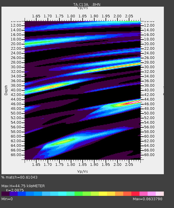
| Arrivals | |
| Ps | 7.5 SECOND |
| PpPs | 21 SECOND |
| PsPs/PpSs | 28 SECOND |

