You are here: Home > Network List > UW - Pacific Northwest Regional Seismic Network Stations List
> Station LEBA Lebam, WA, USA > Earthquake Result Viewer
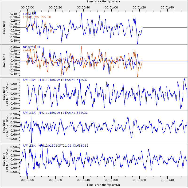
LEBA Lebam, WA, USA - Earthquake Result Viewer
*The percent match for this event was below the threshold and hence no stack was calculated.
| Earthquake location: |
Bonin Islands, Japan Region |
| Earthquake latitude/longitude: |
27.0/140.2 |
| Earthquake time(UTC): |
2018/02/05 (036) 20:56:22 GMT |
| Earthquake Depth: |
465 km |
| Earthquake Magnitude: |
5.3 Mww |
| Earthquake Catalog/Contributor: |
NEIC PDE/us |
|
| Network: |
UW Pacific Northwest Regional Seismic Network |
| Station: |
LEBA Lebam, WA, USA |
| Lat/Lon: |
46.55 N/123.56 W |
| Elevation: |
73 m |
|
| Distance: |
74.9 deg |
| Az: |
45.276 deg |
| Baz: |
293.29 deg |
| Ray Param: |
$rayparam |
*The percent match for this event was below the threshold and hence was not used in the summary stack. |
|
| Radial Match: |
60.710556 % |
| Radial Bump: |
400 |
| Transverse Match: |
52.306812 % |
| Transverse Bump: |
398 |
| SOD ConfigId: |
13570011 |
| Insert Time: |
2019-04-29 17:38:43.302 +0000 |
| GWidth: |
2.5 |
| Max Bumps: |
400 |
| Tol: |
0.001 |
|
Signal To Noise
| Channel | StoN | STA | LTA |
| UW:LEBA: :HHZ:20180205T21:06:43.63803Z | 1.3062061 | 3.777954E-7 | 2.8923108E-7 |
| UW:LEBA: :HHN:20180205T21:06:43.63803Z | 2.377642 | 6.580014E-7 | 2.767454E-7 |
| UW:LEBA: :HHE:20180205T21:06:43.63803Z | 0.44211543 | 1.791243E-7 | 4.0515278E-7 |
| Arrivals |
| Ps | |
| PpPs | |
| PsPs/PpSs | |


