C13A Hot Springs, MT, USA - Earthquake Result Viewer
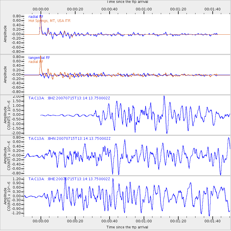
Earthquake location: Fox Islands, Aleutian Islands
Earthquake latitude/longitude: 52.5/-168.0
Earthquake time(UTC): 2007/07/15 (196) 13:08:00 GMT
Earthquake Depth: 10 km
Earthquake Magnitude: 5.8 MB, 5.9 MS, 6.1 MW, 6.0 MW
Earthquake Catalog/Contributor: WHDF/NEIC
Network: TA USArray Transportable Network (new EarthScope stations)
Station: C13A Hot Springs, MT, USA
Lat/Lon: 47.68 N/114.57 W
Elevation: 976 m
Distance: 34.0 deg
Az: 76.273 deg
Baz: 298.447 deg
Ray Param: 0.0779554
Estimated Moho Depth: 37.5 km
Estimated Crust Vp/Vs: 1.71
Assumed Crust Vp: 6.622 km/s
Estimated Crust Vs: 3.867 km/s
Estimated Crust Poisson's Ratio: 0.24
Radial Match: 91.86273 %
Radial Bump: 341
Transverse Match: 81.11768 %
Transverse Bump: 400
SOD ConfigId: 2564
Insert Time: 2010-03-06 08:39:56.611 +0000
GWidth: 2.5
Max Bumps: 400
Tol: 0.001

Signal To Noise

ChannelStoNSTALTA
TA:C13A: :BHN:20070715T13:14:13.750002Z1.82227238.07864E-84.4332783E-8
TA:C13A: :BHE:20070715T13:14:13.750002Z1.95009711.2476252E-76.3977595E-8
TA:C13A: :BHZ:20070715T13:14:13.750002Z5.2142382.9348845E-75.628597E-8
Arrivals
Ps4.4 SECOND
PpPs14 SECOND
PsPs/PpSs18 SECOND