
C13A Hot Springs, MT, USA - Earthquake Result Viewer
| ||||||||||||||||||
| ||||||||||||||||||
| ||||||||||||||||||
|
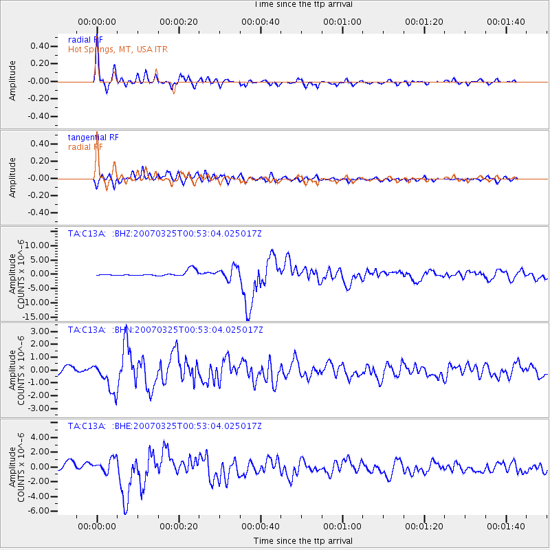
Signal To Noise
| Channel | StoN | STA | LTA |
| TA:C13A: :BHN:20070325T00:53:04.025017Z | 6.7939577 | 1.1944551E-6 | 1.7581138E-7 |
| TA:C13A: :BHE:20070325T00:53:04.025017Z | 2.629477 | 9.4580645E-7 | 3.5969373E-7 |
| TA:C13A: :BHZ:20070325T00:53:04.025017Z | 2.5340984 | 2.150948E-6 | 8.48802E-7 |
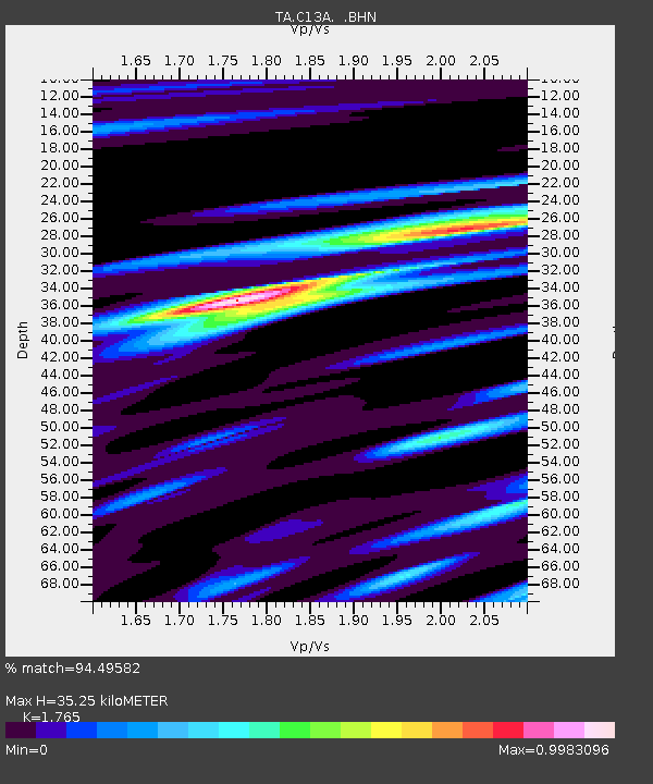
| Arrivals | |
| Ps | 4.2 SECOND |
| PpPs | 14 SECOND |
| PsPs/PpSs | 18 SECOND |

