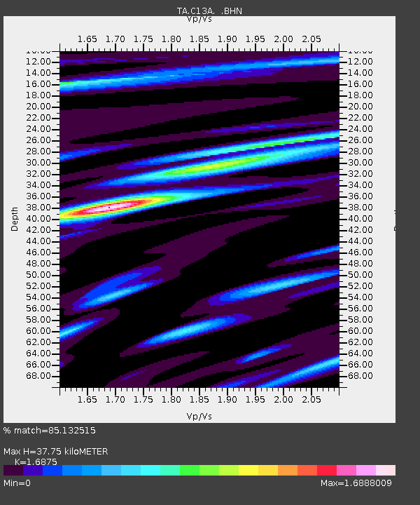
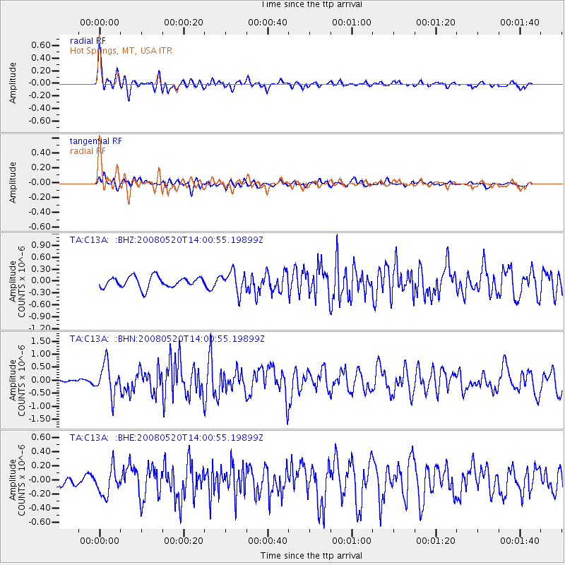
C13A Hot Springs, MT, USA - Earthquake Result Viewer

Earthquake location: Rat Islands, Aleutian Islands
Earthquake latitude/longitude: 51.2/178.8
Earthquake time(UTC): 2008/05/20 (141) 13:53:35 GMT
Earthquake Depth: 27 km
Earthquake Magnitude: 5.8 MB, 6.0 MS, 6.3 MW, 6.3 MW
Earthquake Catalog/Contributor: WHDF/NEIC
Network: TA USArray Transportable Network (new EarthScope stations)
Station: C13A Hot Springs, MT, USA
Lat/Lon: 47.68 N/114.57 W
Elevation: 976 m
Distance: 42.2 deg
Az: 67.561 deg
Baz: 300.54 deg
Ray Param: 0.07328554
Estimated Moho Depth: 37.75 km
Estimated Crust Vp/Vs: 1.69
Assumed Crust Vp: 6.622 km/s
Estimated Crust Vs: 3.924 km/s
Estimated Crust Poisson's Ratio: 0.23
Radial Match: 85.132515 %
Radial Bump: 400
Transverse Match: 74.18662 %
Transverse Bump: 400
SOD ConfigId: 2504
Insert Time: 2010-03-06 08:40:40.665 +0000
GWidth: 2.5
Max Bumps: 400
Tol: 0.001

Signal To Noise

ChannelStoNSTALTA
TA:C13A: :BHN:20080520T14:00:55.19899Z7.14263256.059264E-78.4832365E-8
TA:C13A: :BHE:20080520T14:00:55.19899Z2.4852261.9286324E-77.760391E-8
TA:C13A: :BHZ:20080520T14:00:55.19899Z1.94614492.6590197E-71.3663009E-7
Arrivals
Ps4.2 SECOND
PpPs14 SECOND
PsPs/PpSs18 SECOND