You are here: Home > Network List > TA - USArray Transportable Network (new EarthScope stations) Stations List
> Station L15K Ungalak Mountain, AK, USA > Earthquake Result Viewer
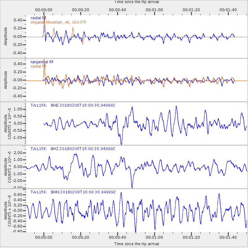
L15K Ungalak Mountain, AK, USA - Earthquake Result Viewer
*The percent match for this event was below the threshold and hence no stack was calculated.
| Earthquake location: |
Taiwan |
| Earthquake latitude/longitude: |
24.2/121.7 |
| Earthquake time(UTC): |
2018/02/06 (037) 15:50:41 GMT |
| Earthquake Depth: |
9.5 km |
| Earthquake Magnitude: |
6.4 Mww |
| Earthquake Catalog/Contributor: |
NEIC PDE/us |
|
| Network: |
TA USArray Transportable Network (new EarthScope stations) |
| Station: |
L15K Ungalak Mountain, AK, USA |
| Lat/Lon: |
61.68 N/161.49 W |
| Elevation: |
219 m |
|
| Distance: |
62.8 deg |
| Az: |
31.47 deg |
| Baz: |
270.721 deg |
| Ray Param: |
$rayparam |
*The percent match for this event was below the threshold and hence was not used in the summary stack. |
|
| Radial Match: |
69.03993 % |
| Radial Bump: |
400 |
| Transverse Match: |
62.74007 % |
| Transverse Bump: |
400 |
| SOD ConfigId: |
13570011 |
| Insert Time: |
2019-04-29 17:44:16.516 +0000 |
| GWidth: |
2.5 |
| Max Bumps: |
400 |
| Tol: |
0.001 |
|
Signal To Noise
| Channel | StoN | STA | LTA |
| TA:L15K: :BHZ:20180206T16:00:36.94999Z | 2.03254 | 6.233097E-7 | 3.0666538E-7 |
| TA:L15K: :BHN:20180206T16:00:36.94999Z | 0.9230621 | 1.7153091E-7 | 1.8582814E-7 |
| TA:L15K: :BHE:20180206T16:00:36.94999Z | 1.5250442 | 2.9842323E-7 | 1.956817E-7 |
| Arrivals |
| Ps | |
| PpPs | |
| PsPs/PpSs | |


