You are here: Home > Network List > TA - USArray Transportable Network (new EarthScope stations) Stations List
> Station C13A Hot Springs, MT, USA > Earthquake Result Viewer
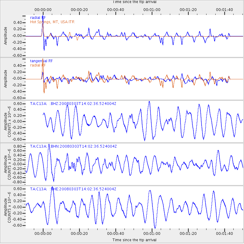
C13A Hot Springs, MT, USA - Earthquake Result Viewer
*The percent match for this event was below the threshold and hence no stack was calculated.
| Earthquake location: |
Philippine Islands Region |
| Earthquake latitude/longitude: |
19.9/121.3 |
| Earthquake time(UTC): |
2008/03/03 (063) 13:49:40 GMT |
| Earthquake Depth: |
10 km |
| Earthquake Magnitude: |
6.0 MB, 6.0 MW, 5.9 MW |
| Earthquake Catalog/Contributor: |
WHDF/NEIC |
|
| Network: |
TA USArray Transportable Network (new EarthScope stations) |
| Station: |
C13A Hot Springs, MT, USA |
| Lat/Lon: |
47.68 N/114.57 W |
| Elevation: |
976 m |
|
| Distance: |
96.1 deg |
| Az: |
34.252 deg |
| Baz: |
308.399 deg |
| Ray Param: |
$rayparam |
*The percent match for this event was below the threshold and hence was not used in the summary stack. |
|
| Radial Match: |
66.7517 % |
| Radial Bump: |
400 |
| Transverse Match: |
36.12096 % |
| Transverse Bump: |
400 |
| SOD ConfigId: |
2504 |
| Insert Time: |
2010-03-06 08:41:13.726 +0000 |
| GWidth: |
2.5 |
| Max Bumps: |
400 |
| Tol: |
0.001 |
|
Signal To Noise
| Channel | StoN | STA | LTA |
| TA:C13A: :BHN:20080303T14:02:36.524004Z | 2.6046455 | 5.05972E-7 | 1.9425754E-7 |
| TA:C13A: :BHE:20080303T14:02:36.524004Z | 2.0704927 | 3.3074676E-7 | 1.5974301E-7 |
| TA:C13A: :BHZ:20080303T14:02:36.524004Z | 0.34922507 | 1.0195644E-7 | 2.919505E-7 |
| Arrivals |
| Ps | |
| PpPs | |
| PsPs/PpSs | |


