You are here: Home > Network List > TA - USArray Transportable Network (new EarthScope stations) Stations List
> Station H16K Elim, AK, USA > Earthquake Result Viewer
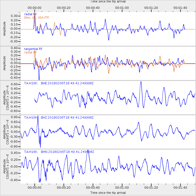
H16K Elim, AK, USA - Earthquake Result Viewer
*The percent match for this event was below the threshold and hence no stack was calculated.
| Earthquake location: |
Vanuatu Islands |
| Earthquake latitude/longitude: |
-19.0/169.5 |
| Earthquake time(UTC): |
2018/02/06 (037) 18:37:59 GMT |
| Earthquake Depth: |
246 km |
| Earthquake Magnitude: |
5.6 Mww |
| Earthquake Catalog/Contributor: |
NEIC PDE/us |
|
| Network: |
TA USArray Transportable Network (new EarthScope stations) |
| Station: |
H16K Elim, AK, USA |
| Lat/Lon: |
64.64 N/162.24 W |
| Elevation: |
216 m |
|
| Distance: |
86.1 deg |
| Az: |
11.807 deg |
| Baz: |
206.718 deg |
| Ray Param: |
$rayparam |
*The percent match for this event was below the threshold and hence was not used in the summary stack. |
|
| Radial Match: |
49.035572 % |
| Radial Bump: |
377 |
| Transverse Match: |
59.98377 % |
| Transverse Bump: |
400 |
| SOD ConfigId: |
13570011 |
| Insert Time: |
2019-04-29 17:49:10.362 +0000 |
| GWidth: |
2.5 |
| Max Bumps: |
400 |
| Tol: |
0.001 |
|
Signal To Noise
| Channel | StoN | STA | LTA |
| TA:H16K: :BHZ:20180206T18:49:41.249998Z | 2.825716 | 4.1177032E-7 | 1.4572248E-7 |
| TA:H16K: :BHN:20180206T18:49:41.249998Z | 1.2447755 | 2.2278233E-7 | 1.7897389E-7 |
| TA:H16K: :BHE:20180206T18:49:41.249998Z | 1.2831062 | 2.205033E-7 | 1.7185117E-7 |
| Arrivals |
| Ps | |
| PpPs | |
| PsPs/PpSs | |


