You are here: Home > Network List > TA - USArray Transportable Network (new EarthScope stations) Stations List
> Station D23K Nanushuk River, AK USA > Earthquake Result Viewer
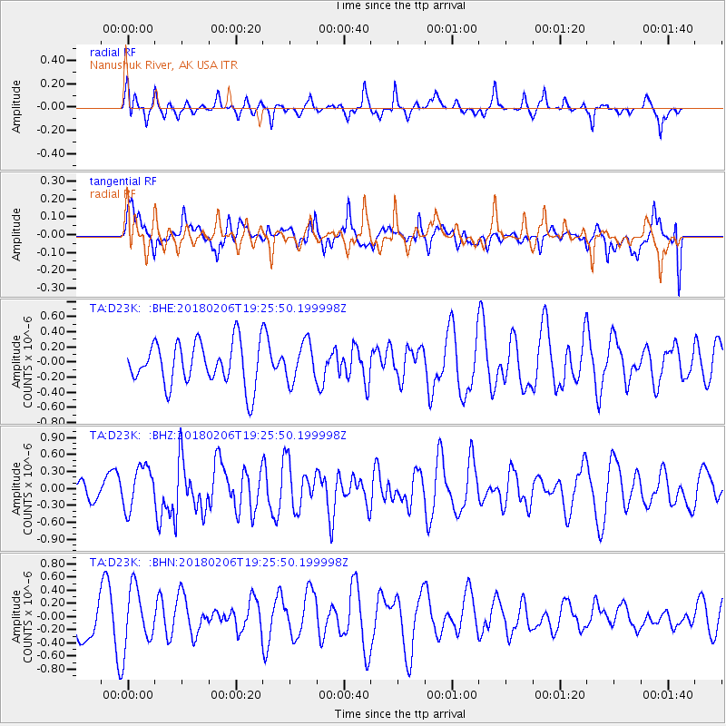
D23K Nanushuk River, AK USA - Earthquake Result Viewer
*The percent match for this event was below the threshold and hence no stack was calculated.
| Earthquake location: |
Taiwan |
| Earthquake latitude/longitude: |
23.9/121.8 |
| Earthquake time(UTC): |
2018/02/06 (037) 19:15:28 GMT |
| Earthquake Depth: |
8.6 km |
| Earthquake Magnitude: |
5.4 Mww |
| Earthquake Catalog/Contributor: |
NEIC PDE/us |
|
| Network: |
TA USArray Transportable Network (new EarthScope stations) |
| Station: |
D23K Nanushuk River, AK USA |
| Lat/Lon: |
68.97 N/150.68 W |
| Elevation: |
406 m |
|
| Distance: |
67.0 deg |
| Az: |
23.066 deg |
| Baz: |
276.825 deg |
| Ray Param: |
$rayparam |
*The percent match for this event was below the threshold and hence was not used in the summary stack. |
|
| Radial Match: |
57.898552 % |
| Radial Bump: |
332 |
| Transverse Match: |
32.977753 % |
| Transverse Bump: |
400 |
| SOD ConfigId: |
13570011 |
| Insert Time: |
2019-04-29 17:53:34.760 +0000 |
| GWidth: |
2.5 |
| Max Bumps: |
400 |
| Tol: |
0.001 |
|
Signal To Noise
| Channel | StoN | STA | LTA |
| TA:D23K: :BHZ:20180206T19:25:50.199998Z | 1.7552056 | 3.870374E-7 | 2.205083E-7 |
| TA:D23K: :BHN:20180206T19:25:50.199998Z | 1.9788309 | 4.29601E-7 | 2.1709837E-7 |
| TA:D23K: :BHE:20180206T19:25:50.199998Z | 0.90719175 | 2.6306765E-7 | 2.899802E-7 |
| Arrivals |
| Ps | |
| PpPs | |
| PsPs/PpSs | |


