You are here: Home > Network List > TA - USArray Transportable Network (new EarthScope stations) Stations List
> Station C13A Hot Springs, MT, USA > Earthquake Result Viewer
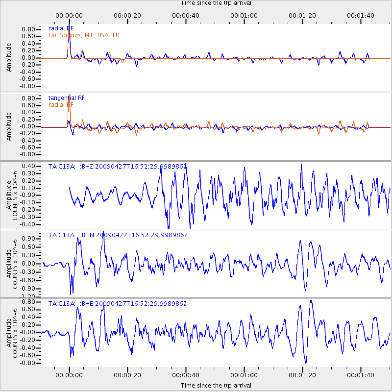
C13A Hot Springs, MT, USA - Earthquake Result Viewer
*The percent match for this event was below the threshold and hence no stack was calculated.
| Earthquake location: |
Guerrero, Mexico |
| Earthquake latitude/longitude: |
17.0/-99.4 |
| Earthquake time(UTC): |
2009/04/27 (117) 16:46:28 GMT |
| Earthquake Depth: |
35 km |
| Earthquake Magnitude: |
5.7 MB, 5.4 MS, 5.8 MW, 5.8 MW |
| Earthquake Catalog/Contributor: |
WHDF/NEIC |
|
| Network: |
TA USArray Transportable Network (new EarthScope stations) |
| Station: |
C13A Hot Springs, MT, USA |
| Lat/Lon: |
47.68 N/114.57 W |
| Elevation: |
976 m |
|
| Distance: |
33.0 deg |
| Az: |
341.108 deg |
| Baz: |
152.716 deg |
| Ray Param: |
$rayparam |
*The percent match for this event was below the threshold and hence was not used in the summary stack. |
|
| Radial Match: |
79.766426 % |
| Radial Bump: |
317 |
| Transverse Match: |
67.12012 % |
| Transverse Bump: |
400 |
| SOD ConfigId: |
2658 |
| Insert Time: |
2010-03-06 08:42:24.843 +0000 |
| GWidth: |
2.5 |
| Max Bumps: |
400 |
| Tol: |
0.001 |
|
Signal To Noise
| Channel | StoN | STA | LTA |
| TA:C13A: :BHN:20090427T16:52:29.998986Z | 6.0537286 | 5.770589E-7 | 9.5322896E-8 |
| TA:C13A: :BHE:20090427T16:52:29.998986Z | 5.355037 | 3.753459E-7 | 7.009212E-8 |
| TA:C13A: :BHZ:20090427T16:52:29.998986Z | 3.4066606 | 2.2245258E-7 | 6.529931E-8 |
| Arrivals |
| Ps | |
| PpPs | |
| PsPs/PpSs | |


