You are here: Home > Network List > TA - USArray Transportable Network (new EarthScope stations) Stations List
> Station C13A Hot Springs, MT, USA > Earthquake Result Viewer
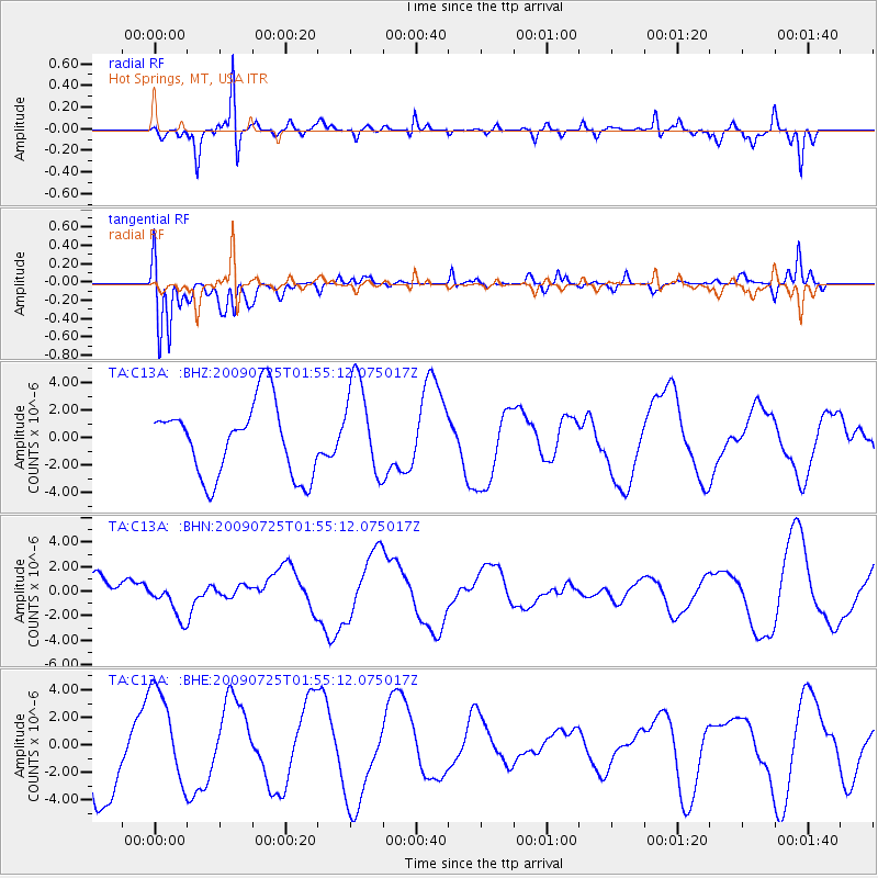
C13A Hot Springs, MT, USA - Earthquake Result Viewer
*The percent match for this event was below the threshold and hence no stack was calculated.
| Earthquake location: |
Solomon Islands |
| Earthquake latitude/longitude: |
-6.5/155.0 |
| Earthquake time(UTC): |
2009/07/25 (206) 01:42:23 GMT |
| Earthquake Depth: |
32 km |
| Earthquake Magnitude: |
5.9 MB, 5.7 MS, 5.9 MW, 5.9 MW |
| Earthquake Catalog/Contributor: |
WHDF/NEIC |
|
| Network: |
TA USArray Transportable Network (new EarthScope stations) |
| Station: |
C13A Hot Springs, MT, USA |
| Lat/Lon: |
47.68 N/114.57 W |
| Elevation: |
976 m |
|
| Distance: |
95.1 deg |
| Az: |
42.716 deg |
| Baz: |
265.965 deg |
| Ray Param: |
$rayparam |
*The percent match for this event was below the threshold and hence was not used in the summary stack. |
|
| Radial Match: |
44.11148 % |
| Radial Bump: |
272 |
| Transverse Match: |
55.081482 % |
| Transverse Bump: |
400 |
| SOD ConfigId: |
2648 |
| Insert Time: |
2010-03-06 08:42:34.661 +0000 |
| GWidth: |
2.5 |
| Max Bumps: |
400 |
| Tol: |
0.001 |
|
Signal To Noise
| Channel | StoN | STA | LTA |
| TA:C13A: :BHN:20090725T01:55:12.075017Z | 1.675757 | 1.4971151E-6 | 8.9339625E-7 |
| TA:C13A: :BHE:20090725T01:55:12.075017Z | 1.3757893 | 3.4668628E-6 | 2.519908E-6 |
| TA:C13A: :BHZ:20090725T01:55:12.075017Z | 1.3240595 | 3.4752914E-6 | 2.6247246E-6 |
| Arrivals |
| Ps | |
| PpPs | |
| PsPs/PpSs | |


