You are here: Home > Network List > TA - USArray Transportable Network (new EarthScope stations) Stations List
> Station D25K Kavik River, AK, USA > Earthquake Result Viewer
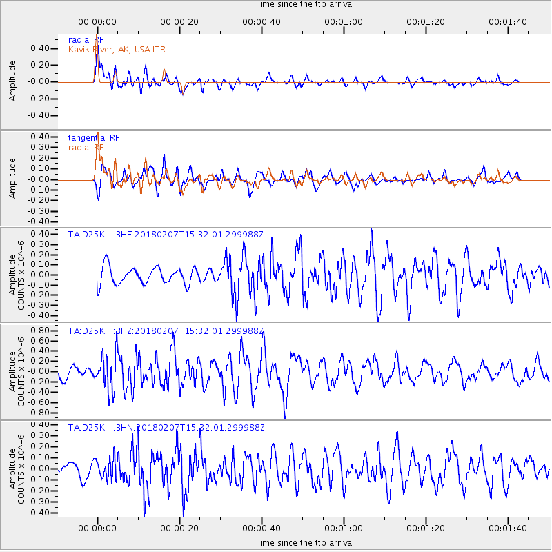
D25K Kavik River, AK, USA - Earthquake Result Viewer
*The percent match for this event was below the threshold and hence no stack was calculated.
| Earthquake location: |
Taiwan |
| Earthquake latitude/longitude: |
24.1/121.7 |
| Earthquake time(UTC): |
2018/02/07 (038) 15:21:31 GMT |
| Earthquake Depth: |
11 km |
| Earthquake Magnitude: |
5.7 Mww |
| Earthquake Catalog/Contributor: |
NEIC PDE/us |
|
| Network: |
TA USArray Transportable Network (new EarthScope stations) |
| Station: |
D25K Kavik River, AK, USA |
| Lat/Lon: |
69.32 N/146.38 W |
| Elevation: |
770 m |
|
| Distance: |
68.4 deg |
| Az: |
22.454 deg |
| Baz: |
280.685 deg |
| Ray Param: |
$rayparam |
*The percent match for this event was below the threshold and hence was not used in the summary stack. |
|
| Radial Match: |
77.95853 % |
| Radial Bump: |
400 |
| Transverse Match: |
71.51089 % |
| Transverse Bump: |
400 |
| SOD ConfigId: |
13570011 |
| Insert Time: |
2019-04-29 18:05:12.738 +0000 |
| GWidth: |
2.5 |
| Max Bumps: |
400 |
| Tol: |
0.001 |
|
Signal To Noise
| Channel | StoN | STA | LTA |
| TA:D25K: :BHZ:20180207T15:32:01.299988Z | 3.0374584 | 3.3674854E-7 | 1.10865244E-7 |
| TA:D25K: :BHN:20180207T15:32:01.299988Z | 0.88490224 | 8.792012E-8 | 9.9355745E-8 |
| TA:D25K: :BHE:20180207T15:32:01.299988Z | 2.2195437 | 1.807887E-7 | 8.1453095E-8 |
| Arrivals |
| Ps | |
| PpPs | |
| PsPs/PpSs | |


