You are here: Home > Network List > TA - USArray Transportable Network (new EarthScope stations) Stations List
> Station I30M Mount Dempster, Yukon, CAN > Earthquake Result Viewer
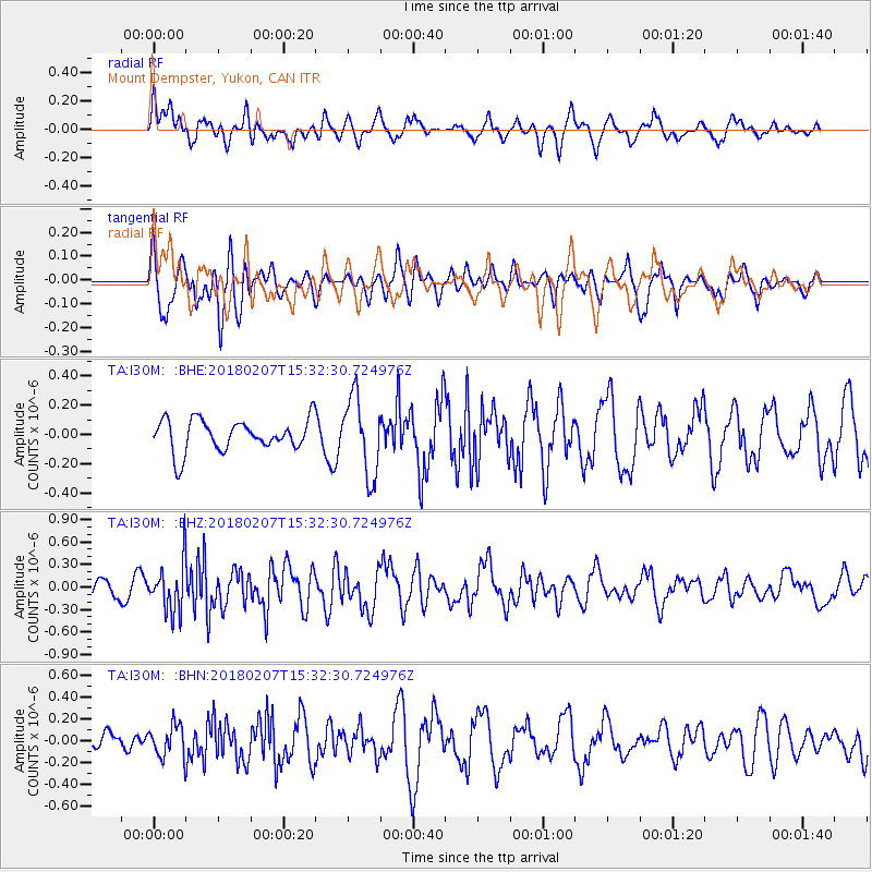
I30M Mount Dempster, Yukon, CAN - Earthquake Result Viewer
*The percent match for this event was below the threshold and hence no stack was calculated.
| Earthquake location: |
Taiwan |
| Earthquake latitude/longitude: |
24.1/121.7 |
| Earthquake time(UTC): |
2018/02/07 (038) 15:21:31 GMT |
| Earthquake Depth: |
11 km |
| Earthquake Magnitude: |
5.7 Mww |
| Earthquake Catalog/Contributor: |
NEIC PDE/us |
|
| Network: |
TA USArray Transportable Network (new EarthScope stations) |
| Station: |
I30M Mount Dempster, Yukon, CAN |
| Lat/Lon: |
65.22 N/136.38 W |
| Elevation: |
1399 m |
|
| Distance: |
73.2 deg |
| Az: |
25.515 deg |
| Baz: |
290.916 deg |
| Ray Param: |
$rayparam |
*The percent match for this event was below the threshold and hence was not used in the summary stack. |
|
| Radial Match: |
55.25615 % |
| Radial Bump: |
400 |
| Transverse Match: |
47.84245 % |
| Transverse Bump: |
400 |
| SOD ConfigId: |
13570011 |
| Insert Time: |
2019-04-29 18:05:30.982 +0000 |
| GWidth: |
2.5 |
| Max Bumps: |
400 |
| Tol: |
0.001 |
|
Signal To Noise
| Channel | StoN | STA | LTA |
| TA:I30M: :BHZ:20180207T15:32:30.724976Z | 2.1038022 | 3.267411E-7 | 1.5530979E-7 |
| TA:I30M: :BHN:20180207T15:32:30.724976Z | 1.1308535 | 1.5009637E-7 | 1.327284E-7 |
| TA:I30M: :BHE:20180207T15:32:30.724976Z | 2.4485946 | 2.651484E-7 | 1.0828595E-7 |
| Arrivals |
| Ps | |
| PpPs | |
| PsPs/PpSs | |


