You are here: Home > Network List > TA - USArray Transportable Network (new EarthScope stations) Stations List
> Station J26L Joseph Creek, AK, USA > Earthquake Result Viewer
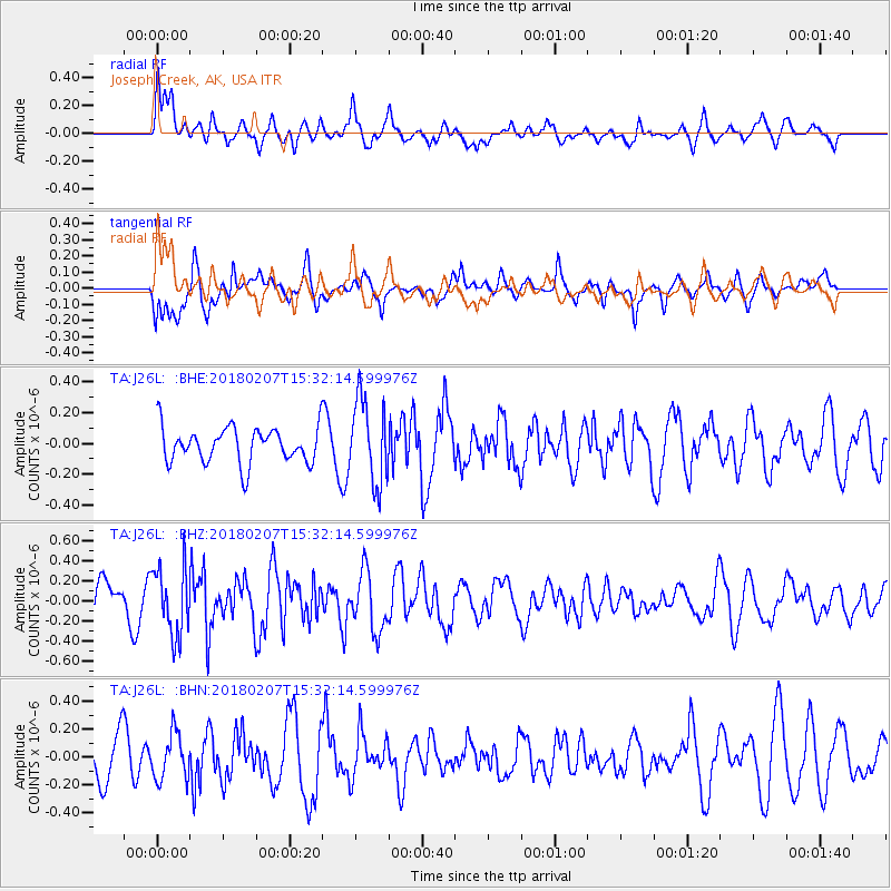
J26L Joseph Creek, AK, USA - Earthquake Result Viewer
*The percent match for this event was below the threshold and hence no stack was calculated.
| Earthquake location: |
Taiwan |
| Earthquake latitude/longitude: |
24.1/121.7 |
| Earthquake time(UTC): |
2018/02/07 (038) 15:21:31 GMT |
| Earthquake Depth: |
11 km |
| Earthquake Magnitude: |
5.7 Mww |
| Earthquake Catalog/Contributor: |
NEIC PDE/us |
|
| Network: |
TA USArray Transportable Network (new EarthScope stations) |
| Station: |
J26L Joseph Creek, AK, USA |
| Lat/Lon: |
64.50 N/143.56 W |
| Elevation: |
1144 m |
|
| Distance: |
70.5 deg |
| Az: |
27.233 deg |
| Baz: |
284.951 deg |
| Ray Param: |
$rayparam |
*The percent match for this event was below the threshold and hence was not used in the summary stack. |
|
| Radial Match: |
66.55027 % |
| Radial Bump: |
400 |
| Transverse Match: |
67.952644 % |
| Transverse Bump: |
400 |
| SOD ConfigId: |
13570011 |
| Insert Time: |
2019-04-29 18:05:32.700 +0000 |
| GWidth: |
2.5 |
| Max Bumps: |
400 |
| Tol: |
0.001 |
|
Signal To Noise
| Channel | StoN | STA | LTA |
| TA:J26L: :BHZ:20180207T15:32:14.599976Z | 2.4032567 | 3.4030177E-7 | 1.4160025E-7 |
| TA:J26L: :BHN:20180207T15:32:14.599976Z | 1.437522 | 1.6424838E-7 | 1.14257986E-7 |
| TA:J26L: :BHE:20180207T15:32:14.599976Z | 2.3407934 | 2.7151313E-7 | 1.1599193E-7 |
| Arrivals |
| Ps | |
| PpPs | |
| PsPs/PpSs | |


