You are here: Home > Network List > TA - USArray Transportable Network (new EarthScope stations) Stations List
> Station G21K Allakaket, AK, USA > Earthquake Result Viewer
G21K Allakaket, AK, USA - Earthquake Result Viewer
*The percent match for this event was below the threshold and hence no stack was calculated.
| Earthquake location: |
Greenland Sea |
| Earthquake latitude/longitude: |
79.8/2.0 |
| Earthquake time(UTC): |
2018/02/08 (039) 02:29:14 GMT |
| Earthquake Depth: |
10 km |
| Earthquake Magnitude: |
5.6 Mww |
| Earthquake Catalog/Contributor: |
NEIC PDE/us |
|
| Network: |
TA USArray Transportable Network (new EarthScope stations) |
| Station: |
G21K Allakaket, AK, USA |
| Lat/Lon: |
66.52 N/153.51 W |
| Elevation: |
446 m |
|
| Distance: |
33.2 deg |
| Az: |
342.367 deg |
| Baz: |
7.737 deg |
| Ray Param: |
$rayparam |
*The percent match for this event was below the threshold and hence was not used in the summary stack. |
|
| Radial Match: |
68.30378 % |
| Radial Bump: |
400 |
| Transverse Match: |
66.7348 % |
| Transverse Bump: |
400 |
| SOD ConfigId: |
13570011 |
| Insert Time: |
2019-04-29 18:12:56.121 +0000 |
| GWidth: |
2.5 |
| Max Bumps: |
400 |
| Tol: |
0.001 |
|
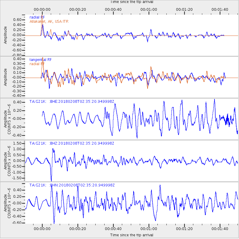
Signal To Noise
| Channel | StoN | STA | LTA |
| TA:G21K: :BHZ:20180208T02:35:20.949998Z | 2.1008332 | 2.5089687E-7 | 1.1942733E-7 |
| TA:G21K: :BHN:20180208T02:35:20.949998Z | 0.8076353 | 8.495293E-8 | 1.0518724E-7 |
| TA:G21K: :BHE:20180208T02:35:20.949998Z | 0.79368085 | 8.625153E-8 | 1.08672815E-7 |
| Arrivals |
| Ps | |
| PpPs | |
| PsPs/PpSs | |


