You are here: Home > Network List > TA - USArray Transportable Network (new EarthScope stations) Stations List
> Station G31M Satah River, YT, CAN > Earthquake Result Viewer
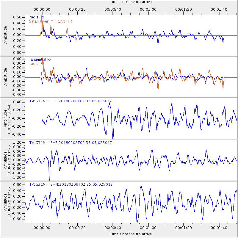
G31M Satah River, YT, CAN - Earthquake Result Viewer
*The percent match for this event was below the threshold and hence no stack was calculated.
| Earthquake location: |
Greenland Sea |
| Earthquake latitude/longitude: |
79.8/2.0 |
| Earthquake time(UTC): |
2018/02/08 (039) 02:29:14 GMT |
| Earthquake Depth: |
10 km |
| Earthquake Magnitude: |
5.6 Mww |
| Earthquake Catalog/Contributor: |
NEIC PDE/us |
|
| Network: |
TA USArray Transportable Network (new EarthScope stations) |
| Station: |
G31M Satah River, YT, CAN |
| Lat/Lon: |
66.92 N/134.27 W |
| Elevation: |
61 m |
|
| Distance: |
31.4 deg |
| Az: |
328.484 deg |
| Baz: |
13.662 deg |
| Ray Param: |
$rayparam |
*The percent match for this event was below the threshold and hence was not used in the summary stack. |
|
| Radial Match: |
64.69876 % |
| Radial Bump: |
400 |
| Transverse Match: |
42.487537 % |
| Transverse Bump: |
362 |
| SOD ConfigId: |
13570011 |
| Insert Time: |
2019-04-29 18:12:57.868 +0000 |
| GWidth: |
2.5 |
| Max Bumps: |
400 |
| Tol: |
0.001 |
|
Signal To Noise
| Channel | StoN | STA | LTA |
| TA:G31M: :BHZ:20180208T02:35:05.02501Z | 2.8562908 | 4.2705594E-7 | 1.4951416E-7 |
| TA:G31M: :BHN:20180208T02:35:05.02501Z | 1.3684158 | 1.8203703E-7 | 1.3302756E-7 |
| TA:G31M: :BHE:20180208T02:35:05.02501Z | 1.7253457 | 1.6363576E-7 | 9.48423E-8 |
| Arrivals |
| Ps | |
| PpPs | |
| PsPs/PpSs | |


