You are here: Home > Network List > US - United States National Seismic Network Stations List
> Station AMTX Amarillo, Texas, USA > Earthquake Result Viewer
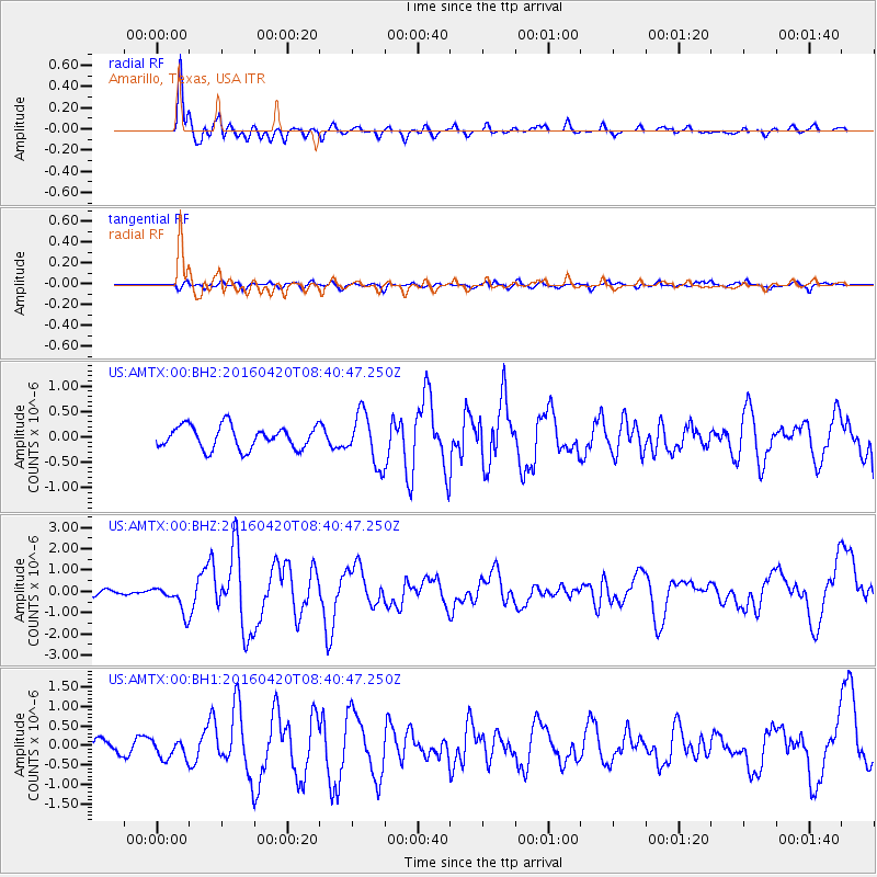
AMTX Amarillo, Texas, USA - Earthquake Result Viewer
*The percent match for this event was below the threshold and hence no stack was calculated.
| Earthquake location: |
Near Coast Of Ecuador |
| Earthquake latitude/longitude: |
0.6/-80.3 |
| Earthquake time(UTC): |
2016/04/20 (111) 08:33:48 GMT |
| Earthquake Depth: |
16 km |
| Earthquake Magnitude: |
6.1 MO |
| Earthquake Catalog/Contributor: |
NEIC PDE/NEIC ALERT |
|
| Network: |
US United States National Seismic Network |
| Station: |
AMTX Amarillo, Texas, USA |
| Lat/Lon: |
34.53 N/101.41 W |
| Elevation: |
1010 m |
|
| Distance: |
39.1 deg |
| Az: |
331.827 deg |
| Baz: |
145.122 deg |
| Ray Param: |
$rayparam |
*The percent match for this event was below the threshold and hence was not used in the summary stack. |
|
| Radial Match: |
90.82394 % |
| Radial Bump: |
331 |
| Transverse Match: |
60.860626 % |
| Transverse Bump: |
400 |
| SOD ConfigId: |
1475611 |
| Insert Time: |
2016-05-04 08:49:36.953 +0000 |
| GWidth: |
2.5 |
| Max Bumps: |
400 |
| Tol: |
0.001 |
|
Signal To Noise
| Channel | StoN | STA | LTA |
| US:AMTX:00:BHZ:20160420T08:40:47.250Z | 3.016526 | 6.193402E-7 | 2.0531573E-7 |
| US:AMTX:00:BH1:20160420T08:40:47.250Z | 1.863846 | 2.457607E-7 | 1.3185677E-7 |
| US:AMTX:00:BH2:20160420T08:40:47.250Z | 1.2341076 | 2.7600572E-7 | 2.2364802E-7 |
| Arrivals |
| Ps | |
| PpPs | |
| PsPs/PpSs | |


