X17A Forest Lakes, AZ, USA - Earthquake Result Viewer
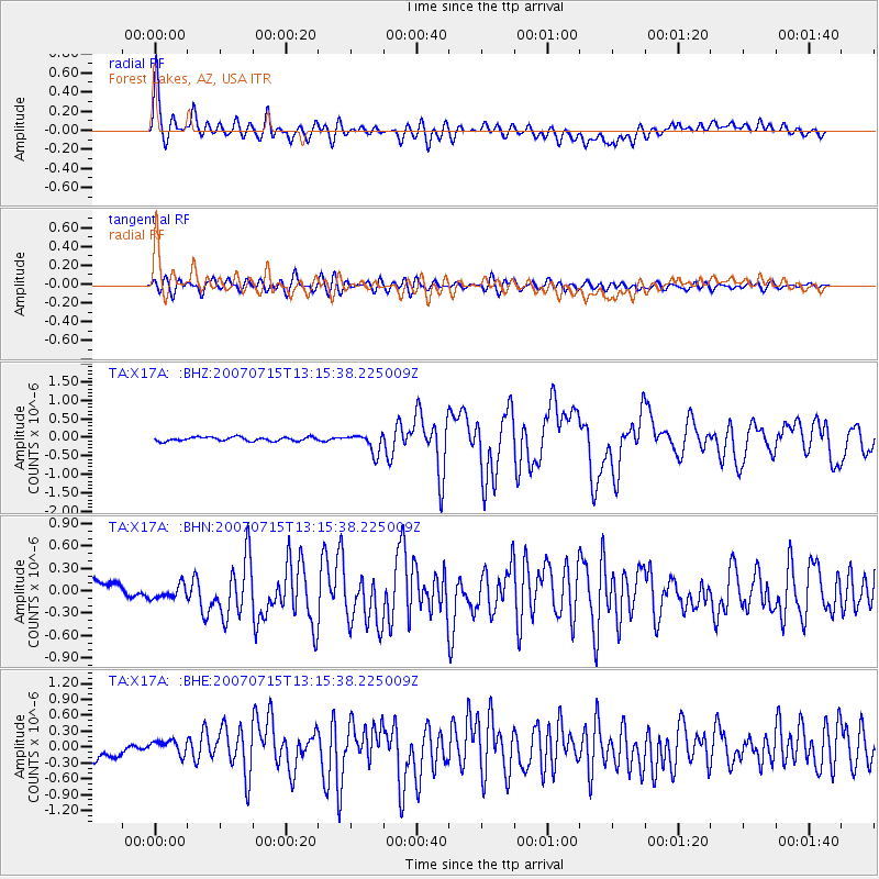
Earthquake location: Fox Islands, Aleutian Islands
Earthquake latitude/longitude: 52.5/-168.0
Earthquake time(UTC): 2007/07/15 (196) 13:08:00 GMT
Earthquake Depth: 10 km
Earthquake Magnitude: 5.8 MB, 5.9 MS, 6.1 MW, 6.0 MW
Earthquake Catalog/Contributor: WHDF/NEIC
Network: TA USArray Transportable Network (new EarthScope stations)
Station: X17A Forest Lakes, AZ, USA
Lat/Lon: 34.34 N/110.81 W
Elevation: 2280 m
Distance: 44.1 deg
Az: 90.892 deg
Baz: 312.35 deg
Ray Param: 0.072121866
Estimated Moho Depth: 39.25 km
Estimated Crust Vp/Vs: 1.91
Assumed Crust Vp: 6.207 km/s
Estimated Crust Vs: 3.254 km/s
Estimated Crust Poisson's Ratio: 0.31
Radial Match: 86.903625 %
Radial Bump: 400
Transverse Match: 74.37097 %
Transverse Bump: 400
SOD ConfigId: 2564
Insert Time: 2010-03-06 08:44:15.463 +0000
GWidth: 2.5
Max Bumps: 400
Tol: 0.001

Signal To Noise

ChannelStoNSTALTA
TA:X17A: :BHN:20070715T13:15:38.225009Z0.98002111.1932511E-71.2175768E-7
TA:X17A: :BHE:20070715T13:15:38.225009Z1.79013531.7775439E-79.929662E-8
TA:X17A: :BHZ:20070715T13:15:38.225009Z4.8688552.5904177E-75.320384E-8
Arrivals
Ps6.1 SECOND
PpPs17 SECOND
PsPs/PpSs23 SECOND