X17A Forest Lakes, AZ, USA - Earthquake Result Viewer
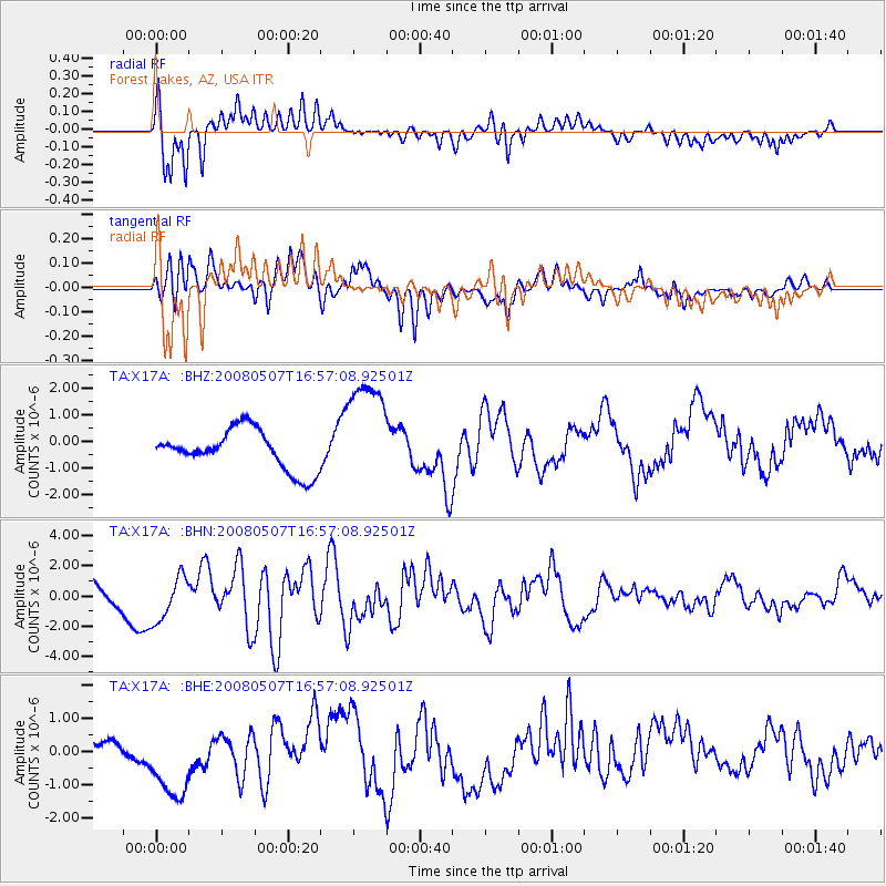
Earthquake location: Near East Coast Of Honshu, Japan
Earthquake latitude/longitude: 36.2/141.5
Earthquake time(UTC): 2008/05/07 (128) 16:45:20 GMT
Earthquake Depth: 39 km
Earthquake Magnitude: 6.1 MB, 6.7 MS, 6.8 MW, 6.8 MW
Earthquake Catalog/Contributor: WHDF/NEIC
Network: TA USArray Transportable Network (new EarthScope stations)
Station: X17A Forest Lakes, AZ, USA
Lat/Lon: 34.34 N/110.81 W
Elevation: 2280 m
Distance: 82.7 deg
Az: 52.639 deg
Baz: 308.984 deg
Ray Param: 0.046625473
Estimated Moho Depth: 45.25 km
Estimated Crust Vp/Vs: 2.10
Assumed Crust Vp: 6.207 km/s
Estimated Crust Vs: 2.959 km/s
Estimated Crust Poisson's Ratio: 0.35
Radial Match: 85.66994 %
Radial Bump: 400
Transverse Match: 73.90786 %
Transverse Bump: 400
SOD ConfigId: 2504
Insert Time: 2010-03-06 08:44:25.157 +0000
GWidth: 2.5
Max Bumps: 400
Tol: 0.001

Signal To Noise

ChannelStoNSTALTA
TA:X17A: :BHN:20080507T16:57:08.92501Z1.4698071.5217147E-61.035316E-6
TA:X17A: :BHE:20080507T16:57:08.92501Z4.49478961.2396879E-62.7580555E-7
TA:X17A: :BHZ:20080507T16:57:08.92501Z2.85513072.1283597E-67.454509E-7
Arrivals
Ps8.2 SECOND
PpPs22 SECOND
PsPs/PpSs30 SECOND