You are here: Home > Network List > TA - USArray Transportable Network (new EarthScope stations) Stations List
> Station X17A Forest Lakes, AZ, USA > Earthquake Result Viewer
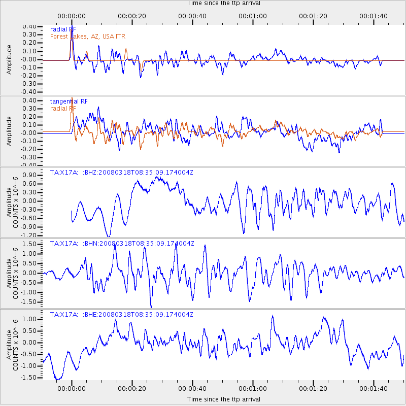
X17A Forest Lakes, AZ, USA - Earthquake Result Viewer
*The percent match for this event was below the threshold and hence no stack was calculated.
| Earthquake location: |
Kermadec Islands, New Zealand |
| Earthquake latitude/longitude: |
-29.3/-177.4 |
| Earthquake time(UTC): |
2008/03/18 (078) 08:22:47 GMT |
| Earthquake Depth: |
25 km |
| Earthquake Magnitude: |
5.8 MB, 6.1 MS, 6.2 MW, 6.2 MW |
| Earthquake Catalog/Contributor: |
WHDF/NEIC |
|
| Network: |
TA USArray Transportable Network (new EarthScope stations) |
| Station: |
X17A Forest Lakes, AZ, USA |
| Lat/Lon: |
34.34 N/110.81 W |
| Elevation: |
2280 m |
|
| Distance: |
89.2 deg |
| Az: |
49.438 deg |
| Baz: |
233.349 deg |
| Ray Param: |
$rayparam |
*The percent match for this event was below the threshold and hence was not used in the summary stack. |
|
| Radial Match: |
65.99202 % |
| Radial Bump: |
400 |
| Transverse Match: |
18.206566 % |
| Transverse Bump: |
400 |
| SOD ConfigId: |
2504 |
| Insert Time: |
2010-03-06 08:44:40.969 +0000 |
| GWidth: |
2.5 |
| Max Bumps: |
400 |
| Tol: |
0.001 |
|
Signal To Noise
| Channel | StoN | STA | LTA |
| TA:X17A: :BHN:20080318T08:35:09.174004Z | 1.4803505 | 3.1031735E-7 | 2.0962425E-7 |
| TA:X17A: :BHE:20080318T08:35:09.174004Z | 1.3981112 | 9.37868E-7 | 6.7081066E-7 |
| TA:X17A: :BHZ:20080318T08:35:09.174004Z | 1.7188063 | 8.6709775E-7 | 5.0447676E-7 |
| Arrivals |
| Ps | |
| PpPs | |
| PsPs/PpSs | |


