You are here: Home > Network List > TA - USArray Transportable Network (new EarthScope stations) Stations List
> Station X17A Forest Lakes, AZ, USA > Earthquake Result Viewer
X17A Forest Lakes, AZ, USA - Earthquake Result Viewer
*The percent match for this event was below the threshold and hence no stack was calculated.
| Earthquake location: |
South Of Panama |
| Earthquake latitude/longitude: |
5.0/-82.7 |
| Earthquake time(UTC): |
2008/06/17 (169) 17:42:09 GMT |
| Earthquake Depth: |
10 km |
| Earthquake Magnitude: |
5.6 MB, 5.3 MS, 5.9 MW, 5.9 MW |
| Earthquake Catalog/Contributor: |
WHDF/NEIC |
|
| Network: |
TA USArray Transportable Network (new EarthScope stations) |
| Station: |
X17A Forest Lakes, AZ, USA |
| Lat/Lon: |
34.34 N/110.81 W |
| Elevation: |
2280 m |
|
| Distance: |
39.1 deg |
| Az: |
321.796 deg |
| Baz: |
131.877 deg |
| Ray Param: |
$rayparam |
*The percent match for this event was below the threshold and hence was not used in the summary stack. |
|
| Radial Match: |
64.55608 % |
| Radial Bump: |
400 |
| Transverse Match: |
34.325073 % |
| Transverse Bump: |
400 |
| SOD ConfigId: |
2504 |
| Insert Time: |
2010-03-06 08:44:52.149 +0000 |
| GWidth: |
2.5 |
| Max Bumps: |
400 |
| Tol: |
0.001 |
|
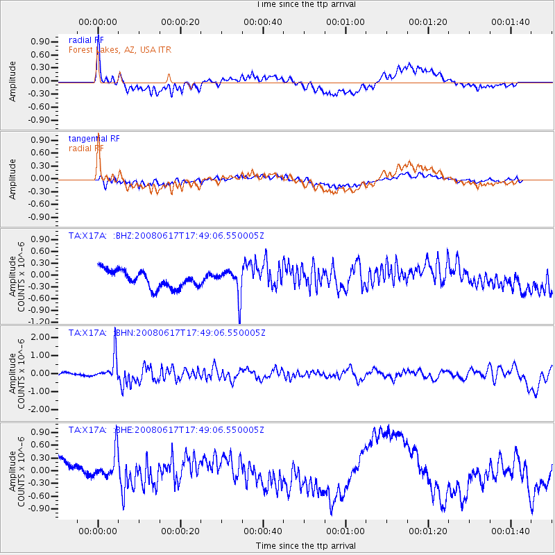
Signal To Noise
| Channel | StoN | STA | LTA |
| TA:X17A: :BHN:20080617T17:49:06.550005Z | 6.8813396 | 7.111258E-7 | 1.0334118E-7 |
| TA:X17A: :BHE:20080617T17:49:06.550005Z | 1.1464213 | 3.2656794E-7 | 2.8485857E-7 |
| TA:X17A: :BHZ:20080617T17:49:06.550005Z | 1.6289929 | 3.50492E-7 | 2.1515869E-7 |
| Arrivals |
| Ps | |
| PpPs | |
| PsPs/PpSs | |


