You are here: Home > Network List > CI - Caltech Regional Seismic Network Stations List
> Station MPP McPhearson Peak > Earthquake Result Viewer
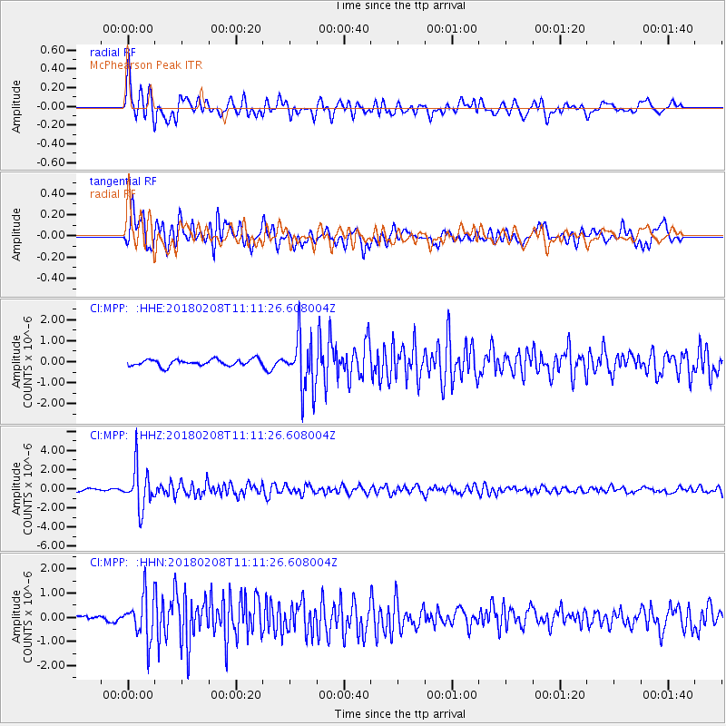
MPP McPhearson Peak - Earthquake Result Viewer
*The percent match for this event was below the threshold and hence no stack was calculated.
| Earthquake location: |
Andreanof Islands, Aleutian Is. |
| Earthquake latitude/longitude: |
52.6/-179.5 |
| Earthquake time(UTC): |
2018/02/08 (039) 11:04:01 GMT |
| Earthquake Depth: |
211 km |
| Earthquake Magnitude: |
5.6 Mww |
| Earthquake Catalog/Contributor: |
NEIC PDE/us |
|
| Network: |
CI Caltech Regional Seismic Network |
| Station: |
MPP McPhearson Peak |
| Lat/Lon: |
34.89 N/119.81 W |
| Elevation: |
1739 m |
|
| Distance: |
45.2 deg |
| Az: |
88.511 deg |
| Baz: |
312.075 deg |
| Ray Param: |
$rayparam |
*The percent match for this event was below the threshold and hence was not used in the summary stack. |
|
| Radial Match: |
79.68701 % |
| Radial Bump: |
400 |
| Transverse Match: |
67.25736 % |
| Transverse Bump: |
400 |
| SOD ConfigId: |
13570011 |
| Insert Time: |
2019-04-29 18:17:07.315 +0000 |
| GWidth: |
2.5 |
| Max Bumps: |
400 |
| Tol: |
0.001 |
|
Signal To Noise
| Channel | StoN | STA | LTA |
| CI:MPP: :HHZ:20180208T11:11:26.608004Z | 11.384093 | 2.1590552E-6 | 1.8965544E-7 |
| CI:MPP: :HHN:20180208T11:11:26.608004Z | 5.067025 | 8.918634E-7 | 1.7601322E-7 |
| CI:MPP: :HHE:20180208T11:11:26.608004Z | 8.429002 | 1.2864791E-6 | 1.5262532E-7 |
| Arrivals |
| Ps | |
| PpPs | |
| PsPs/PpSs | |


