You are here: Home > Network List > CI - Caltech Regional Seismic Network Stations List
> Station MPM Manuel Prospect Mine, California, USA > Earthquake Result Viewer
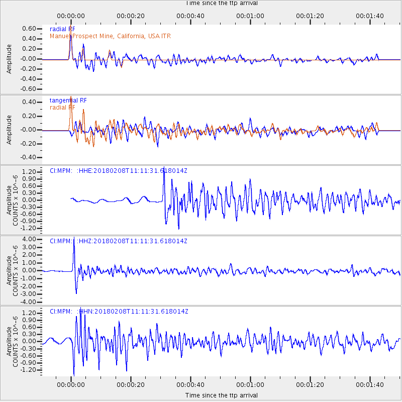
MPM Manuel Prospect Mine, California, USA - Earthquake Result Viewer
*The percent match for this event was below the threshold and hence no stack was calculated.
| Earthquake location: |
Andreanof Islands, Aleutian Is. |
| Earthquake latitude/longitude: |
52.6/-179.5 |
| Earthquake time(UTC): |
2018/02/08 (039) 11:04:01 GMT |
| Earthquake Depth: |
211 km |
| Earthquake Magnitude: |
5.6 Mww |
| Earthquake Catalog/Contributor: |
NEIC PDE/us |
|
| Network: |
CI Caltech Regional Seismic Network |
| Station: |
MPM Manuel Prospect Mine, California, USA |
| Lat/Lon: |
36.06 N/117.49 W |
| Elevation: |
185 m |
|
| Distance: |
45.8 deg |
| Az: |
85.521 deg |
| Baz: |
311.323 deg |
| Ray Param: |
$rayparam |
*The percent match for this event was below the threshold and hence was not used in the summary stack. |
|
| Radial Match: |
72.364685 % |
| Radial Bump: |
400 |
| Transverse Match: |
65.501724 % |
| Transverse Bump: |
400 |
| SOD ConfigId: |
13570011 |
| Insert Time: |
2019-04-29 18:17:07.847 +0000 |
| GWidth: |
2.5 |
| Max Bumps: |
400 |
| Tol: |
0.001 |
|
Signal To Noise
| Channel | StoN | STA | LTA |
| CI:MPM: :HHZ:20180208T11:11:31.618014Z | 19.937328 | 1.3215868E-6 | 6.628706E-8 |
| CI:MPM: :HHN:20180208T11:11:31.618014Z | 8.425901 | 6.369667E-7 | 7.559627E-8 |
| CI:MPM: :HHE:20180208T11:11:31.618014Z | 7.9641104 | 5.5461436E-7 | 6.963921E-8 |
| Arrivals |
| Ps | |
| PpPs | |
| PsPs/PpSs | |


