You are here: Home > Network List > TA - USArray Transportable Network (new EarthScope stations) Stations List
> Station X17A Forest Lakes, AZ, USA > Earthquake Result Viewer
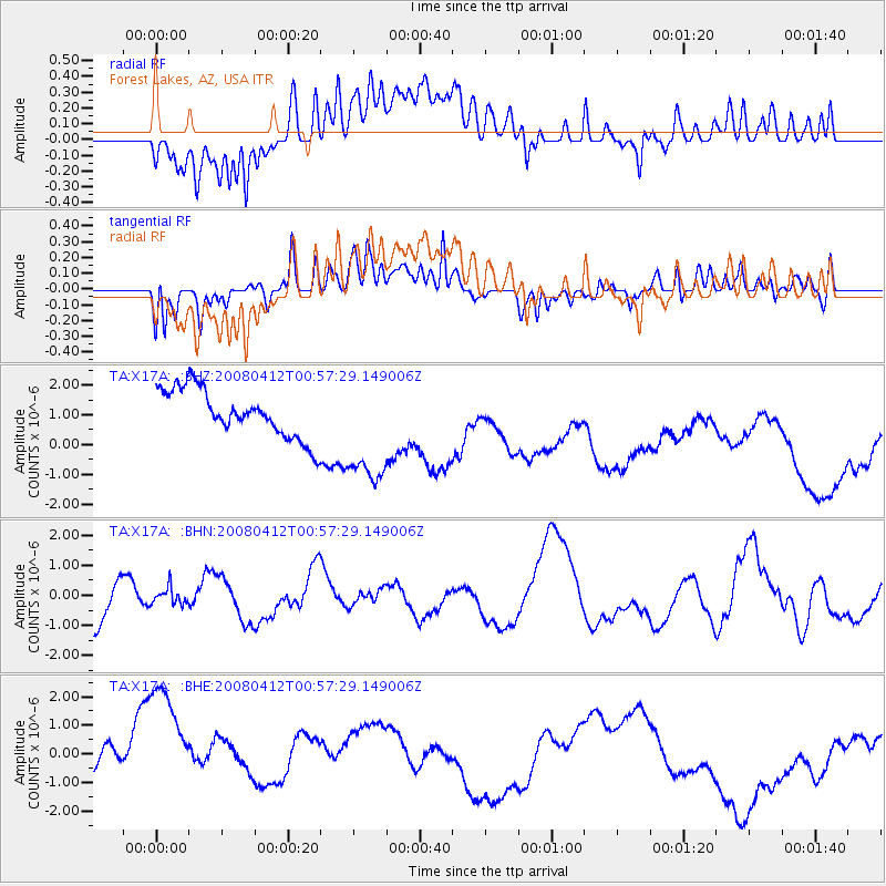
X17A Forest Lakes, AZ, USA - Earthquake Result Viewer
*The percent match for this event was below the threshold and hence no stack was calculated.
| Earthquake location: |
Kuril Islands |
| Earthquake latitude/longitude: |
43.9/147.5 |
| Earthquake time(UTC): |
2008/04/12 (103) 00:46:28 GMT |
| Earthquake Depth: |
64 km |
| Earthquake Magnitude: |
5.7 MB |
| Earthquake Catalog/Contributor: |
WHDF/NEIC |
|
| Network: |
TA USArray Transportable Network (new EarthScope stations) |
| Station: |
X17A Forest Lakes, AZ, USA |
| Lat/Lon: |
34.34 N/110.81 W |
| Elevation: |
2280 m |
|
| Distance: |
74.5 deg |
| Az: |
57.218 deg |
| Baz: |
312.718 deg |
| Ray Param: |
$rayparam |
*The percent match for this event was below the threshold and hence was not used in the summary stack. |
|
| Radial Match: |
27.547731 % |
| Radial Bump: |
400 |
| Transverse Match: |
45.81331 % |
| Transverse Bump: |
400 |
| SOD ConfigId: |
2504 |
| Insert Time: |
2010-03-06 08:45:23.461 +0000 |
| GWidth: |
2.5 |
| Max Bumps: |
400 |
| Tol: |
0.001 |
|
Signal To Noise
| Channel | StoN | STA | LTA |
| TA:X17A: :BHN:20080412T00:57:29.149006Z | 0.33939856 | 2.7748283E-7 | 8.175722E-7 |
| TA:X17A: :BHE:20080412T00:57:29.149006Z | 3.7183568 | 3.121023E-6 | 8.3935544E-7 |
| TA:X17A: :BHZ:20080412T00:57:29.149006Z | 2.3935344 | 1.9280812E-6 | 8.0553724E-7 |
| Arrivals |
| Ps | |
| PpPs | |
| PsPs/PpSs | |


