You are here: Home > Network List > TA - USArray Transportable Network (new EarthScope stations) Stations List
> Station X17A Forest Lakes, AZ, USA > Earthquake Result Viewer
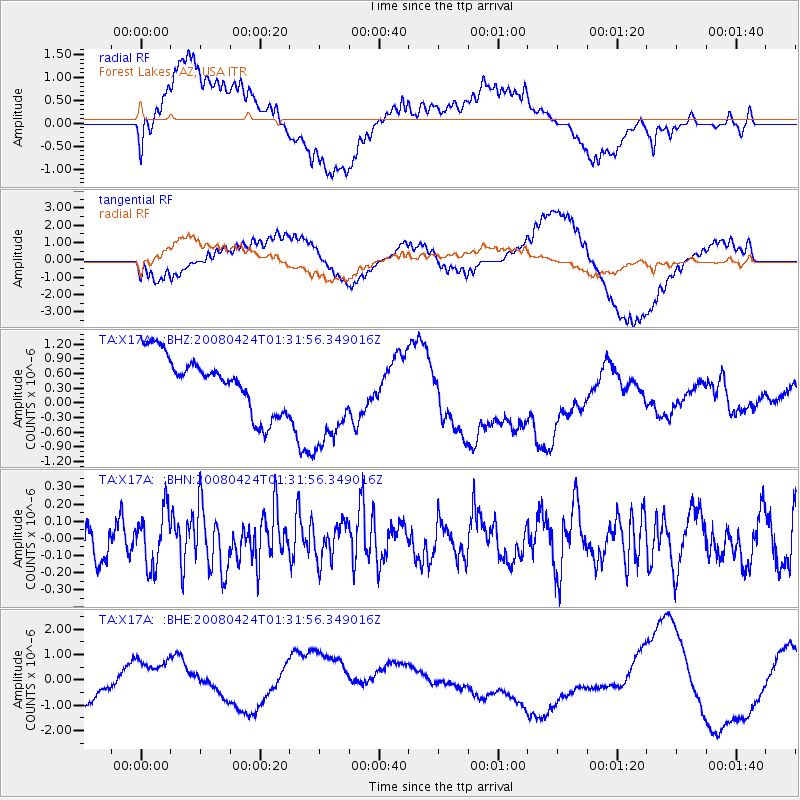
X17A Forest Lakes, AZ, USA - Earthquake Result Viewer
*The percent match for this event was below the threshold and hence no stack was calculated.
| Earthquake location: |
Loyalty Islands |
| Earthquake latitude/longitude: |
-20.1/168.7 |
| Earthquake time(UTC): |
2008/04/24 (115) 01:19:15 GMT |
| Earthquake Depth: |
35 km |
| Earthquake Magnitude: |
5.7 MW, 5.3 MS, 5.3 MB, 5.6 MW |
| Earthquake Catalog/Contributor: |
WHDF/NEIC |
|
| Network: |
TA USArray Transportable Network (new EarthScope stations) |
| Station: |
X17A Forest Lakes, AZ, USA |
| Lat/Lon: |
34.34 N/110.81 W |
| Elevation: |
2280 m |
|
| Distance: |
93.6 deg |
| Az: |
54.854 deg |
| Baz: |
248.271 deg |
| Ray Param: |
$rayparam |
*The percent match for this event was below the threshold and hence was not used in the summary stack. |
|
| Radial Match: |
60.43128 % |
| Radial Bump: |
400 |
| Transverse Match: |
59.37321 % |
| Transverse Bump: |
400 |
| SOD ConfigId: |
2504 |
| Insert Time: |
2010-03-06 08:45:26.527 +0000 |
| GWidth: |
2.5 |
| Max Bumps: |
400 |
| Tol: |
0.001 |
|
Signal To Noise
| Channel | StoN | STA | LTA |
| TA:X17A: :BHN:20080424T01:31:56.349016Z | 1.2154003 | 1.6120597E-7 | 1.3263612E-7 |
| TA:X17A: :BHE:20080424T01:31:56.349016Z | 1.6764137 | 1.1958622E-6 | 7.133455E-7 |
| TA:X17A: :BHZ:20080424T01:31:56.349016Z | 1.8863543 | 1.0825983E-6 | 5.7391037E-7 |
| Arrivals |
| Ps | |
| PpPs | |
| PsPs/PpSs | |


