
K15A Arbon, ID, USA - Earthquake Result Viewer
| ||||||||||||||||||
| ||||||||||||||||||
| ||||||||||||||||||
|
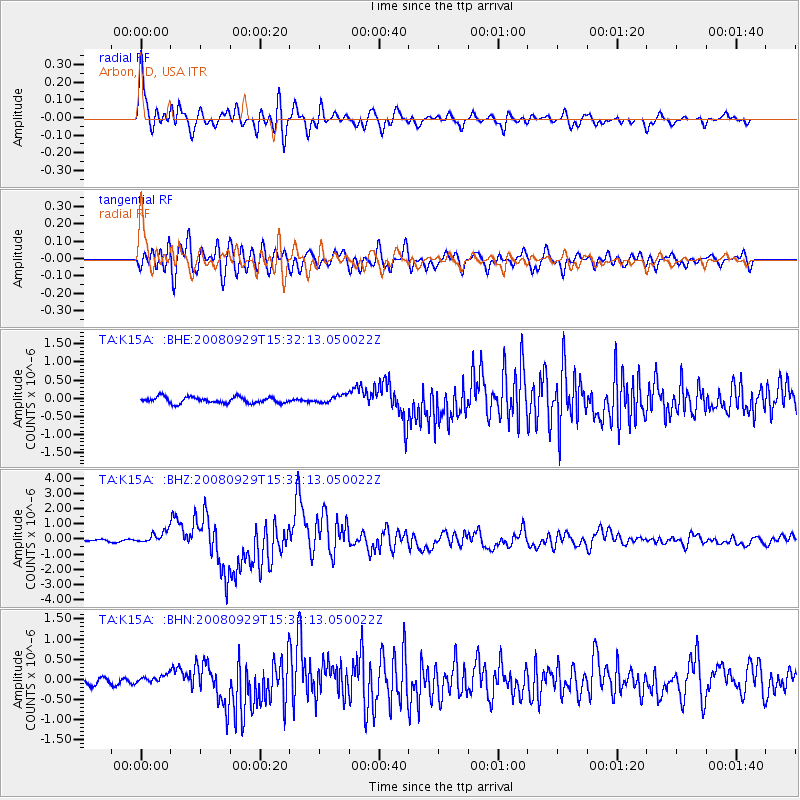
Signal To Noise
| Channel | StoN | STA | LTA |
| TA:K15A: :BHZ:20080929T15:32:13.050022Z | 7.5192995 | 4.106213E-7 | 5.4608986E-8 |
| TA:K15A: :BHN:20080929T15:32:13.050022Z | 2.110865 | 1.08995046E-7 | 5.1635247E-8 |
| TA:K15A: :BHE:20080929T15:32:13.050022Z | 1.2764585 | 1.07562904E-7 | 8.426667E-8 |
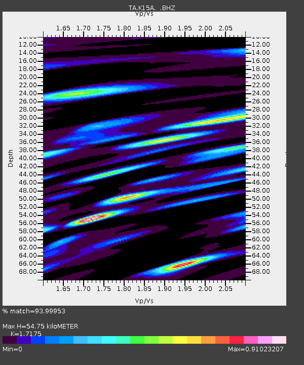
| Arrivals | |
| Ps | 6.4 SECOND |
| PpPs | 23 SECOND |
| PsPs/PpSs | 30 SECOND |

