K15A Arbon, ID, USA - Earthquake Result Viewer
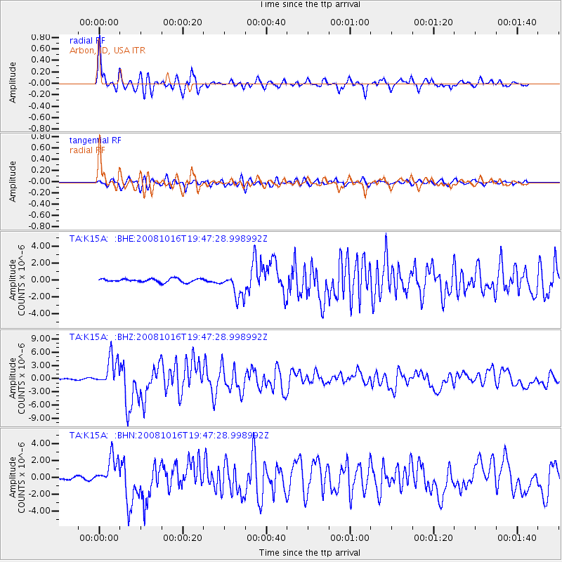
Earthquake location: Near Coast Of Chiapas, Mexico
Earthquake latitude/longitude: 14.4/-92.4
Earthquake time(UTC): 2008/10/16 (290) 19:41:25 GMT
Earthquake Depth: 24 km
Earthquake Magnitude: 6.1 MB, 6.6 MS, 6.7 MW, 6.6 MW
Earthquake Catalog/Contributor: WHDF/NEIC
Network: TA USArray Transportable Network (new EarthScope stations)
Station: K15A Arbon, ID, USA
Lat/Lon: 42.69 N/112.53 W
Elevation: 1566 m
Distance: 33.1 deg
Az: 332.251 deg
Baz: 142.28 deg
Ray Param: 0.07833659
Estimated Moho Depth: 36.75 km
Estimated Crust Vp/Vs: 1.79
Assumed Crust Vp: 6.279 km/s
Estimated Crust Vs: 3.503 km/s
Estimated Crust Poisson's Ratio: 0.27
Radial Match: 93.70459 %
Radial Bump: 400
Transverse Match: 89.9593 %
Transverse Bump: 400
SOD ConfigId: 2560
Insert Time: 2010-03-06 08:46:29.345 +0000
GWidth: 2.5
Max Bumps: 400
Tol: 0.001

Signal To Noise

ChannelStoNSTALTA
TA:K15A: :BHZ:20081016T19:47:28.998992Z23.101313.429013E-61.484337E-7
TA:K15A: :BHN:20081016T19:47:28.998992Z14.1359011.7856153E-61.2631774E-7
TA:K15A: :BHE:20081016T19:47:28.998992Z7.27319671.4842649E-62.0407326E-7
Arrivals
Ps5.0 SECOND
PpPs15 SECOND
PsPs/PpSs20 SECOND