You are here: Home > Network List > TA - USArray Transportable Network (new EarthScope stations) Stations List
> Station M53A WI Miller and Sons, Farmdale, OH, USA > Earthquake Result Viewer
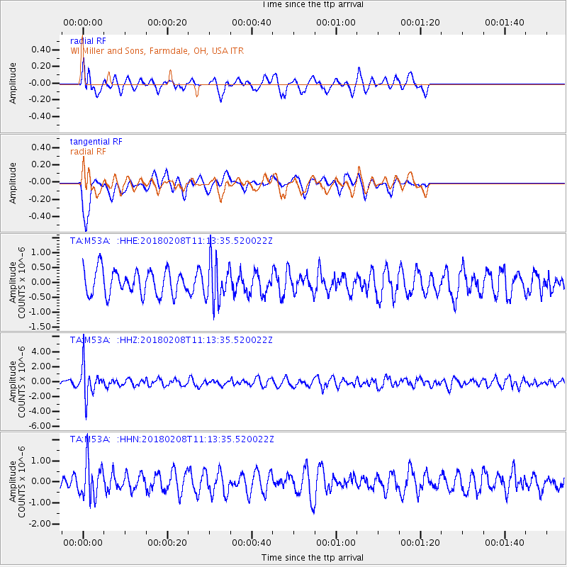
M53A WI Miller and Sons, Farmdale, OH, USA - Earthquake Result Viewer
*The percent match for this event was below the threshold and hence no stack was calculated.
| Earthquake location: |
Andreanof Islands, Aleutian Is. |
| Earthquake latitude/longitude: |
52.6/-179.5 |
| Earthquake time(UTC): |
2018/02/08 (039) 11:04:01 GMT |
| Earthquake Depth: |
211 km |
| Earthquake Magnitude: |
5.6 Mww |
| Earthquake Catalog/Contributor: |
NEIC PDE/us |
|
| Network: |
TA USArray Transportable Network (new EarthScope stations) |
| Station: |
M53A WI Miller and Sons, Farmdale, OH, USA |
| Lat/Lon: |
41.44 N/80.68 W |
| Elevation: |
334 m |
|
| Distance: |
63.1 deg |
| Az: |
56.419 deg |
| Baz: |
317.44 deg |
| Ray Param: |
$rayparam |
*The percent match for this event was below the threshold and hence was not used in the summary stack. |
|
| Radial Match: |
68.53394 % |
| Radial Bump: |
400 |
| Transverse Match: |
69.76677 % |
| Transverse Bump: |
400 |
| SOD ConfigId: |
13570011 |
| Insert Time: |
2019-04-29 18:24:00.056 +0000 |
| GWidth: |
2.5 |
| Max Bumps: |
400 |
| Tol: |
0.001 |
|
Signal To Noise
| Channel | StoN | STA | LTA |
| TA:M53A: :HHZ:20180208T11:13:35.520022Z | 3.402168 | 2.0545006E-6 | 6.038798E-7 |
| TA:M53A: :HHN:20180208T11:13:35.520022Z | 4.218736 | 8.7702426E-7 | 2.0788792E-7 |
| TA:M53A: :HHE:20180208T11:13:35.520022Z | 1.6406446 | 6.801208E-7 | 4.1454493E-7 |
| Arrivals |
| Ps | |
| PpPs | |
| PsPs/PpSs | |


