
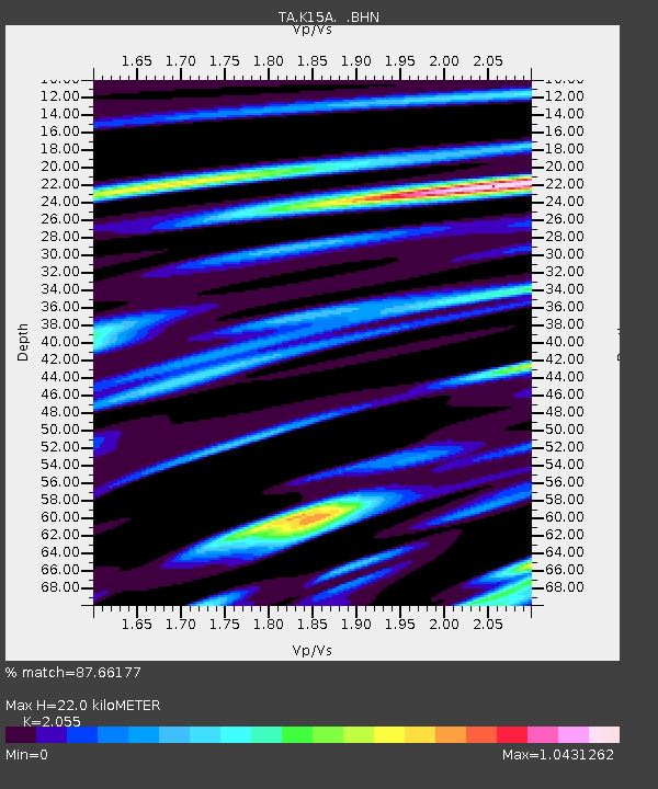
K15A Arbon, ID, USA - Earthquake Result Viewer
| ||||||||||||||||||
| ||||||||||||||||||
| ||||||||||||||||||
|
Signal To Noise
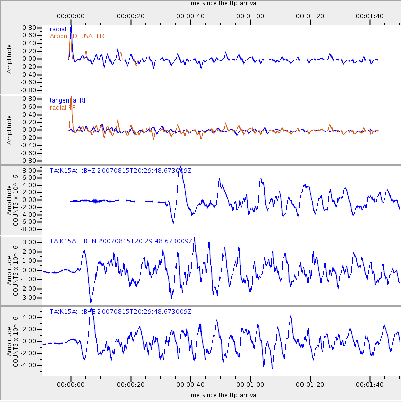
| Channel | StoN | STA | LTA |
| TA:K15A: :BHN:20070815T20:29:48.673009Z | 6.965867 | 9.2801304E-7 | 1.332229E-7 |
| TA:K15A: :BHE:20070815T20:29:48.673009Z | 3.3519583 | 1.1373313E-6 | 3.3930354E-7 |
| TA:K15A: :BHZ:20070815T20:29:48.673009Z | 19.287386 | 2.4311194E-6 | 1.260471E-7 |
| Arrivals | |
| Ps | 3.9 SECOND |
| PpPs | 10 SECOND |
| PsPs/PpSs | 14 SECOND |

