K15A Arbon, ID, USA - Earthquake Result Viewer
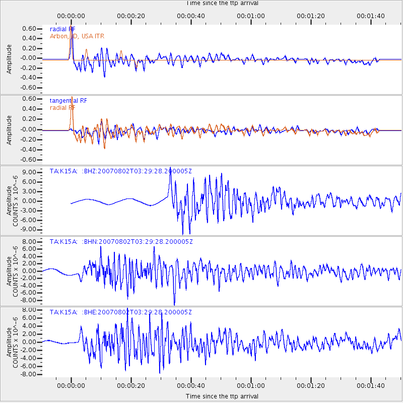
Earthquake location: Andreanof Islands, Aleutian Is.
Earthquake latitude/longitude: 51.3/-180.0
Earthquake time(UTC): 2007/08/02 (214) 03:21:42 GMT
Earthquake Depth: 21 km
Earthquake Magnitude: 6.3 MB, 6.6 MS, 6.7 MW, 6.6 MW
Earthquake Catalog/Contributor: WHDF/NEIC
Network: TA USArray Transportable Network (new EarthScope stations)
Station: K15A Arbon, ID, USA
Lat/Lon: 42.69 N/112.53 W
Elevation: 1566 m
Distance: 45.3 deg
Az: 73.337 deg
Baz: 305.359 deg
Ray Param: 0.071340024
Estimated Moho Depth: 66.5 km
Estimated Crust Vp/Vs: 2.08
Assumed Crust Vp: 6.279 km/s
Estimated Crust Vs: 3.015 km/s
Estimated Crust Poisson's Ratio: 0.35
Radial Match: 87.7873 %
Radial Bump: 400
Transverse Match: 80.50513 %
Transverse Bump: 400
SOD ConfigId: 2564
Insert Time: 2010-03-06 08:47:25.186 +0000
GWidth: 2.5
Max Bumps: 400
Tol: 0.001

Signal To Noise

ChannelStoNSTALTA
TA:K15A: :BHN:20070802T03:29:28.200005Z2.32198431.2028547E-65.1802886E-7
TA:K15A: :BHE:20070802T03:29:28.200005Z2.53606441.3648821E-65.3818906E-7
TA:K15A: :BHZ:20070802T03:29:28.200005Z6.09114653.4429402E-65.652368E-7
Arrivals
Ps12 SECOND
PpPs31 SECOND
PsPs/PpSs43 SECOND