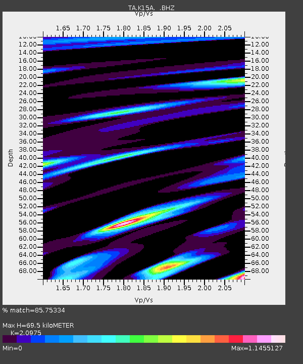
K15A Arbon, ID, USA - Earthquake Result Viewer
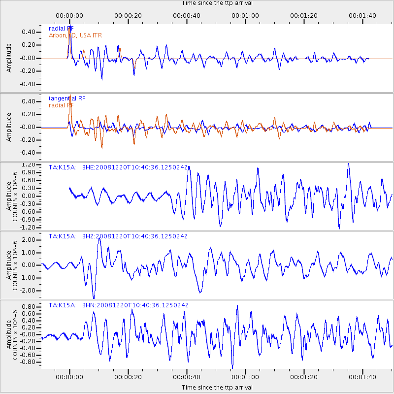
Earthquake location: Off East Coast Of Honshu, Japan
Earthquake latitude/longitude: 36.5/142.4
Earthquake time(UTC): 2008/12/20 (355) 10:29:23 GMT
Earthquake Depth: 19 km
Earthquake Magnitude: 6.0 MB, 6.3 MS, 6.3 MW, 6.3 MW
Earthquake Catalog/Contributor: WHDF/NEIC
Network: TA USArray Transportable Network (new EarthScope stations)
Station: K15A Arbon, ID, USA
Lat/Lon: 42.69 N/112.53 W
Elevation: 1566 m
Distance: 75.7 deg
Az: 47.283 deg
Baz: 306.635 deg
Ray Param: 0.05144748
Estimated Moho Depth: 69.5 km
Estimated Crust Vp/Vs: 2.10
Assumed Crust Vp: 6.279 km/s
Estimated Crust Vs: 2.993 km/s
Estimated Crust Poisson's Ratio: 0.35
Radial Match: 85.75334 %
Radial Bump: 400
Transverse Match: 61.65662 %
Transverse Bump: 400
SOD ConfigId: 2658
Insert Time: 2010-03-06 08:47:33.534 +0000
GWidth: 2.5
Max Bumps: 400
Tol: 0.001

Signal To Noise

ChannelStoNSTALTA
TA:K15A: :BHZ:20081220T10:40:36.125024Z2.53159172.6873664E-71.0615324E-7
TA:K15A: :BHN:20081220T10:40:36.125024Z0.55693738.1919396E-81.470891E-7
TA:K15A: :BHE:20081220T10:40:36.125024Z0.67511371.04157586E-71.5428154E-7
Arrivals
Ps12 SECOND
PpPs33 SECOND
PsPs/PpSs46 SECOND