
K15A Arbon, ID, USA - Earthquake Result Viewer
| ||||||||||||||||||
| ||||||||||||||||||
| ||||||||||||||||||
|
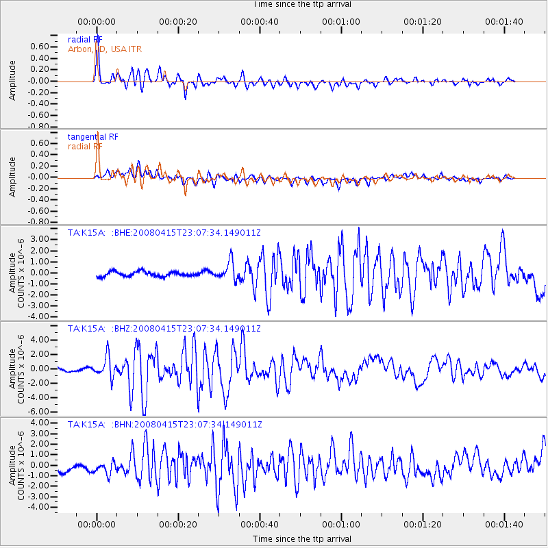
Signal To Noise
| Channel | StoN | STA | LTA |
| TA:K15A: :BHZ:20080415T23:07:34.149011Z | 6.0916886 | 1.4760495E-6 | 2.4230548E-7 |
| TA:K15A: :BHN:20080415T23:07:34.149011Z | 1.3861262 | 7.0946544E-7 | 5.118332E-7 |
| TA:K15A: :BHE:20080415T23:07:34.149011Z | 4.0036526 | 8.5490825E-7 | 2.1353206E-7 |
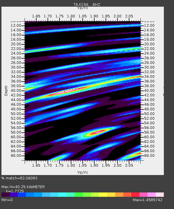
| Arrivals | |
| Ps | 5.3 SECOND |
| PpPs | 17 SECOND |
| PsPs/PpSs | 22 SECOND |

