
K15A Arbon, ID, USA - Earthquake Result Viewer
| ||||||||||||||||||
| ||||||||||||||||||
| ||||||||||||||||||
|
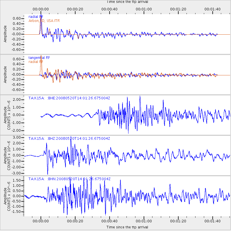
Signal To Noise
| Channel | StoN | STA | LTA |
| TA:K15A: :BHZ:20080520T14:01:26.675004Z | 15.640765 | 9.934387E-7 | 6.351599E-8 |
| TA:K15A: :BHN:20080520T14:01:26.675004Z | 3.5195262 | 3.0081398E-7 | 8.547002E-8 |
| TA:K15A: :BHE:20080520T14:01:26.675004Z | 4.1573772 | 4.6518548E-7 | 1.11893975E-7 |
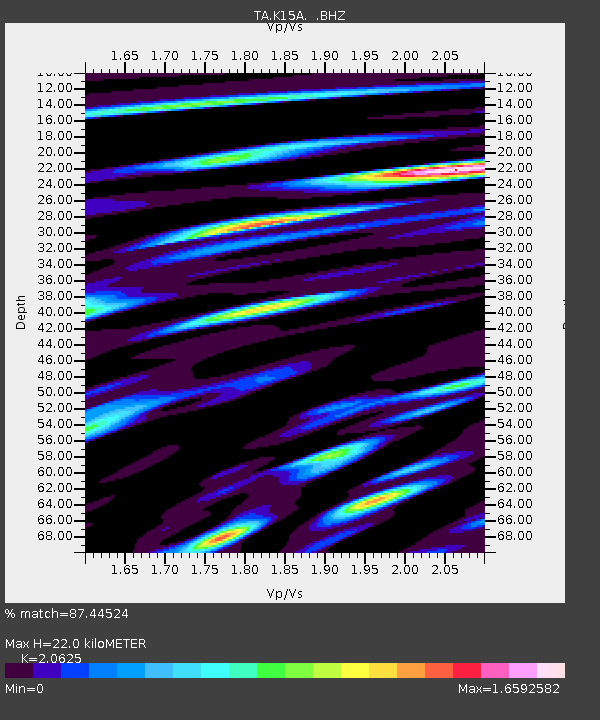
| Arrivals | |
| Ps | 3.9 SECOND |
| PpPs | 10 SECOND |
| PsPs/PpSs | 14 SECOND |

