You are here: Home > Network List > TA - USArray Transportable Network (new EarthScope stations) Stations List
> Station K15A Arbon, ID, USA > Earthquake Result Viewer
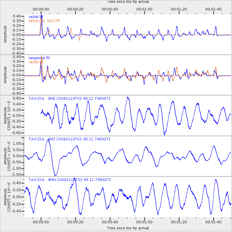
K15A Arbon, ID, USA - Earthquake Result Viewer
*The percent match for this event was below the threshold and hence no stack was calculated.
| Earthquake location: |
Southeast Of Loyalty Islands |
| Earthquake latitude/longitude: |
-22.6/170.9 |
| Earthquake time(UTC): |
2009/01/19 (019) 03:35:18 GMT |
| Earthquake Depth: |
12 km |
| Earthquake Magnitude: |
5.7 MB, 6.4 MS, 6.5 MW, 6.5 MW |
| Earthquake Catalog/Contributor: |
WHDF/NEIC |
|
| Network: |
TA USArray Transportable Network (new EarthScope stations) |
| Station: |
K15A Arbon, ID, USA |
| Lat/Lon: |
42.69 N/112.53 W |
| Elevation: |
1566 m |
|
| Distance: |
95.7 deg |
| Az: |
46.116 deg |
| Baz: |
244.599 deg |
| Ray Param: |
$rayparam |
*The percent match for this event was below the threshold and hence was not used in the summary stack. |
|
| Radial Match: |
62.595978 % |
| Radial Bump: |
400 |
| Transverse Match: |
57.443058 % |
| Transverse Bump: |
400 |
| SOD ConfigId: |
2658 |
| Insert Time: |
2010-03-06 08:49:35.249 +0000 |
| GWidth: |
2.5 |
| Max Bumps: |
400 |
| Tol: |
0.001 |
|
Signal To Noise
| Channel | StoN | STA | LTA |
| TA:K15A: :BHZ:20090119T03:48:12.748997Z | 9.392723 | 7.5994615E-7 | 8.090797E-8 |
| TA:K15A: :BHN:20090119T03:48:12.748997Z | 0.8752766 | 1.4812997E-7 | 1.692379E-7 |
| TA:K15A: :BHE:20090119T03:48:12.748997Z | 0.8792756 | 2.0924445E-7 | 2.3797367E-7 |
| Arrivals |
| Ps | |
| PpPs | |
| PsPs/PpSs | |


