You are here: Home > Network List > CN - Canadian National Seismograph Network Stations List
> Station INK INUVIK, NT > Earthquake Result Viewer
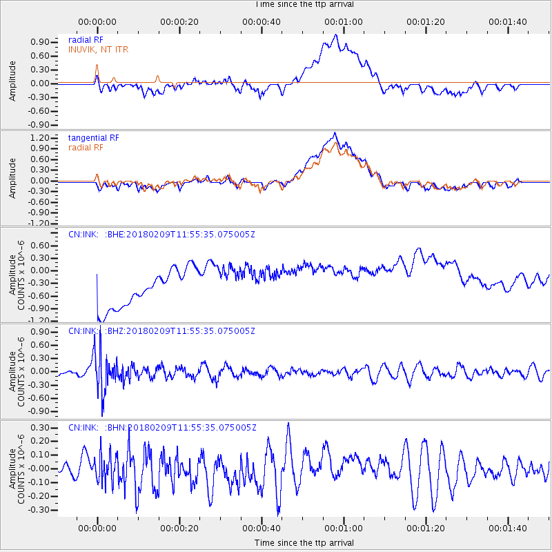
INK INUVIK, NT - Earthquake Result Viewer
*The percent match for this event was below the threshold and hence no stack was calculated.
| Earthquake location: |
Fiji Islands Region |
| Earthquake latitude/longitude: |
-17.9/-178.7 |
| Earthquake time(UTC): |
2018/02/09 (040) 11:43:56 GMT |
| Earthquake Depth: |
545 km |
| Earthquake Magnitude: |
5.9 Mww |
| Earthquake Catalog/Contributor: |
NEIC PDE/us |
|
| Network: |
CN Canadian National Seismograph Network |
| Station: |
INK INUVIK, NT |
| Lat/Lon: |
68.31 N/133.53 W |
| Elevation: |
44 m |
|
| Distance: |
91.9 deg |
| Az: |
15.289 deg |
| Baz: |
222.482 deg |
| Ray Param: |
$rayparam |
*The percent match for this event was below the threshold and hence was not used in the summary stack. |
|
| Radial Match: |
29.087797 % |
| Radial Bump: |
400 |
| Transverse Match: |
27.705284 % |
| Transverse Bump: |
400 |
| SOD ConfigId: |
13570011 |
| Insert Time: |
2019-04-29 18:36:54.461 +0000 |
| GWidth: |
2.5 |
| Max Bumps: |
400 |
| Tol: |
0.001 |
|
Signal To Noise
| Channel | StoN | STA | LTA |
| CN:INK: :BHZ:20180209T11:55:35.075005Z | 4.258202 | 4.4369395E-7 | 1.0419749E-7 |
| CN:INK: :BHN:20180209T11:55:35.075005Z | 1.132954 | 9.869182E-8 | 8.711017E-8 |
| CN:INK: :BHE:20180209T11:55:35.075005Z | 1.0420111 | 4.5158643E-7 | 4.3337968E-7 |
| Arrivals |
| Ps | |
| PpPs | |
| PsPs/PpSs | |


