You are here: Home > Network List > TA - USArray Transportable Network (new EarthScope stations) Stations List
> Station K15A Arbon, ID, USA > Earthquake Result Viewer
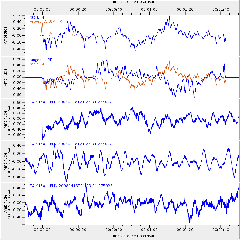
K15A Arbon, ID, USA - Earthquake Result Viewer
*The percent match for this event was below the threshold and hence no stack was calculated.
| Earthquake location: |
Kermadec Islands Region |
| Earthquake latitude/longitude: |
-27.5/-176.6 |
| Earthquake time(UTC): |
2008/04/18 (109) 21:10:56 GMT |
| Earthquake Depth: |
10 km |
| Earthquake Magnitude: |
5.6 MS, 5.4 MB, 5.8 MW, 5.8 MW |
| Earthquake Catalog/Contributor: |
WHDF/NEIC |
|
| Network: |
TA USArray Transportable Network (new EarthScope stations) |
| Station: |
K15A Arbon, ID, USA |
| Lat/Lon: |
42.69 N/112.53 W |
| Elevation: |
1566 m |
|
| Distance: |
91.4 deg |
| Az: |
41.544 deg |
| Baz: |
233.01 deg |
| Ray Param: |
$rayparam |
*The percent match for this event was below the threshold and hence was not used in the summary stack. |
|
| Radial Match: |
49.924973 % |
| Radial Bump: |
400 |
| Transverse Match: |
22.751516 % |
| Transverse Bump: |
400 |
| SOD ConfigId: |
2504 |
| Insert Time: |
2010-03-06 08:49:45.056 +0000 |
| GWidth: |
2.5 |
| Max Bumps: |
400 |
| Tol: |
0.001 |
|
Signal To Noise
| Channel | StoN | STA | LTA |
| TA:K15A: :BHZ:20080418T21:23:31.27502Z | 1.582721 | 1.5560141E-7 | 9.83126E-8 |
| TA:K15A: :BHN:20080418T21:23:31.27502Z | 0.8538633 | 4.378013E-7 | 5.1272997E-7 |
| TA:K15A: :BHE:20080418T21:23:31.27502Z | 2.3411992 | 4.280781E-7 | 1.8284567E-7 |
| Arrivals |
| Ps | |
| PpPs | |
| PsPs/PpSs | |


